The Canol Heritage Trail uses the Northwest Territories section
(372 km) of the gravel road that was built in 1942-5 to service
the CANOL (CANadian OiL) No. 1 crude-oil pipeline that was
abandoned in 1945. The land has largely reverted to a wild state
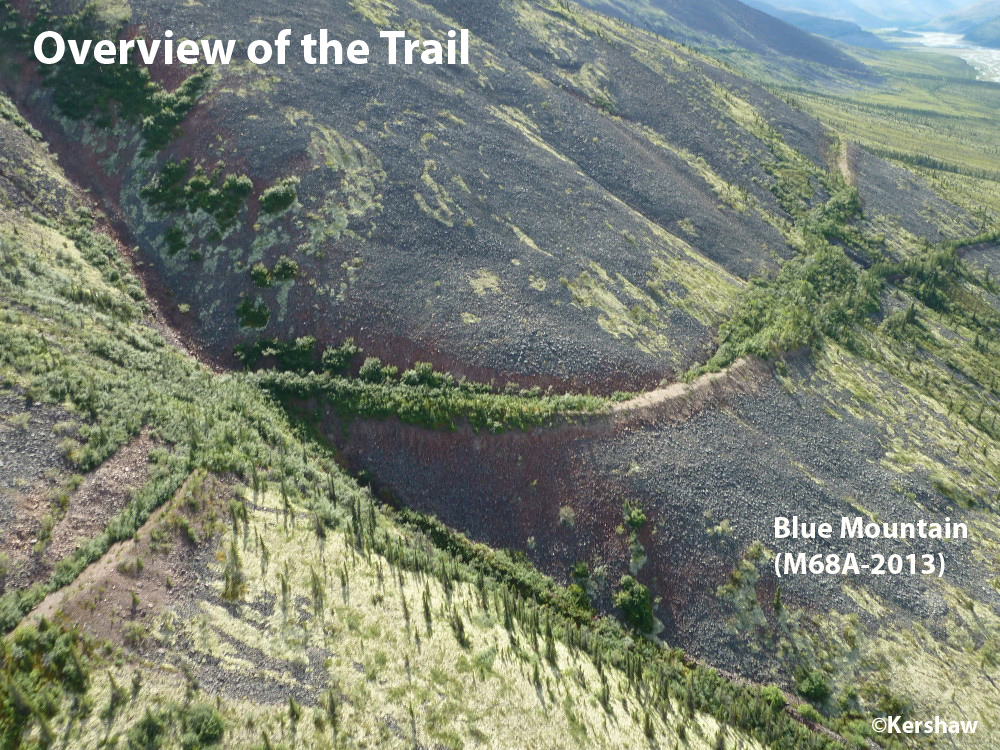
as natural processes have reclaimed the right-of-way. Remaining
sections of the roadbed are mostly obvious and excellent for
backpacking. However, the erosive action of running water, the
thawing of permafrost and dense tree and shrub colonization in
some sections have obliterated the original road bed. Buildings
have been demolished or sealed and no functioning bridges remain.
In short, the Trail offers a unique wilderness trekking experience
for prepared, knowledgable and fit backcountry users.
Currently the DoI T'oh and Canol Heritage
Trail are classed as Park Reserves under the 1993 Sahtu Dene and
Metis Comprehensive Land Claim Agreement,
presumably awaiting final agreements after the 2019 completion of
remediation of hazards caused by the CANOL Project. Over the
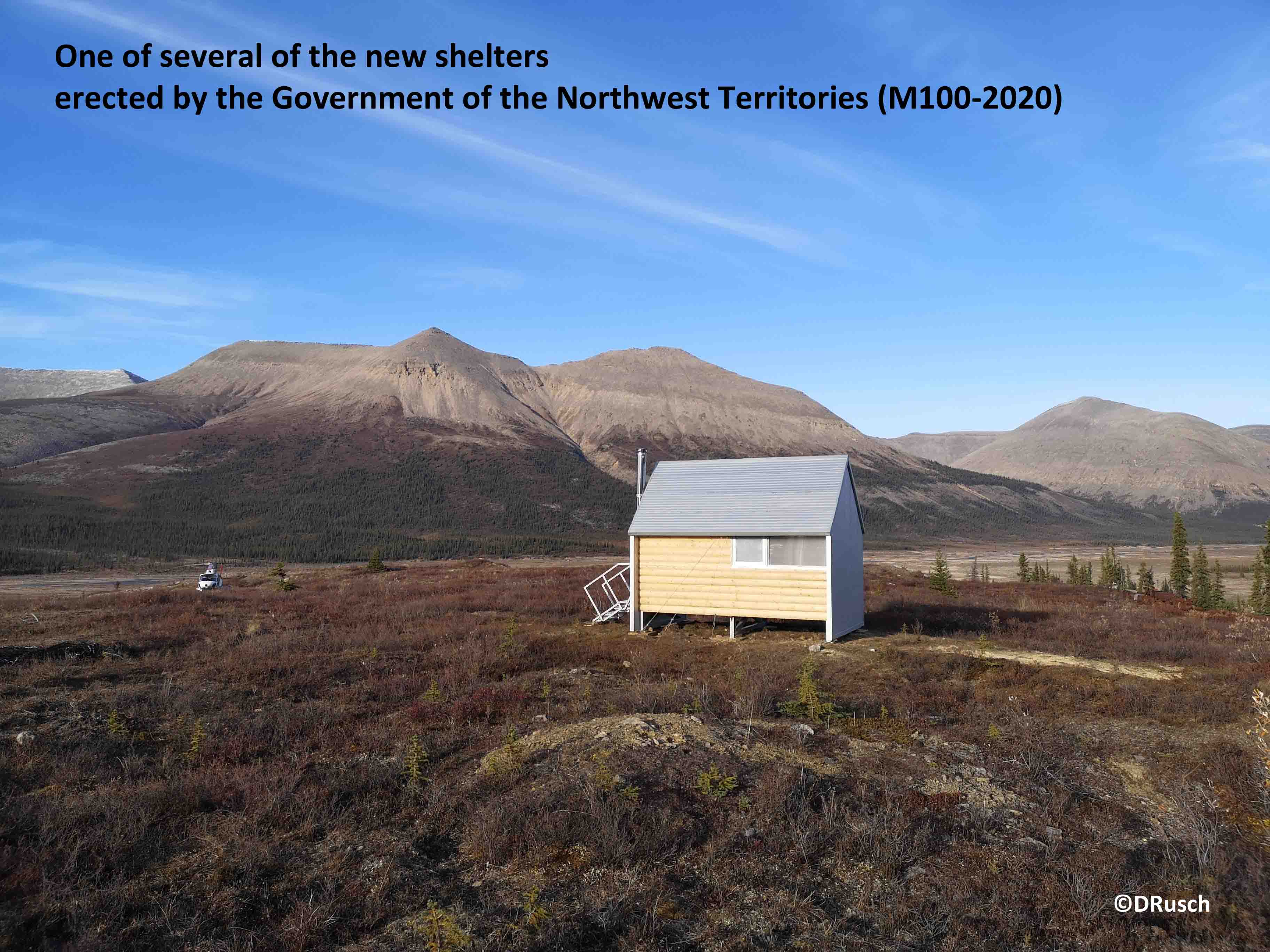
past few years the Government of the Northwest Territories,
(Tourism & Parks, Department of Industry, Tourism &
Investment) have erected shelters at five locations with more
planned.
Things to Note/Recommendations
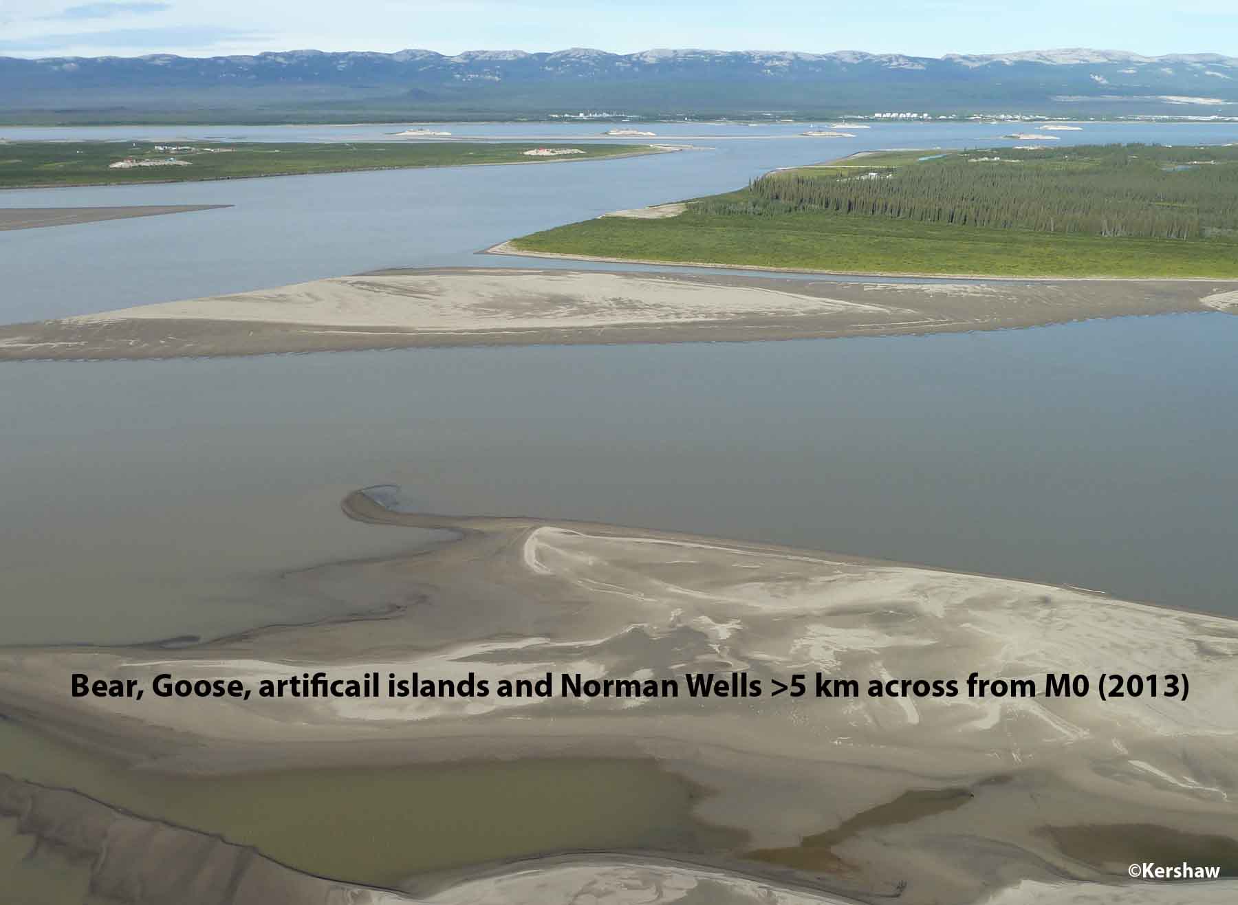
- The Mackenzie River consists of
extremely fast, roiling, turbid water spanning more than 5km
between the Norman Wells boat launch and the start of the
Trail. Even experienced paddlers cannot expect to float or
paddle across without ending up far downstream from their
intended landing. Talk to locals about arranging a motorized
crossing.
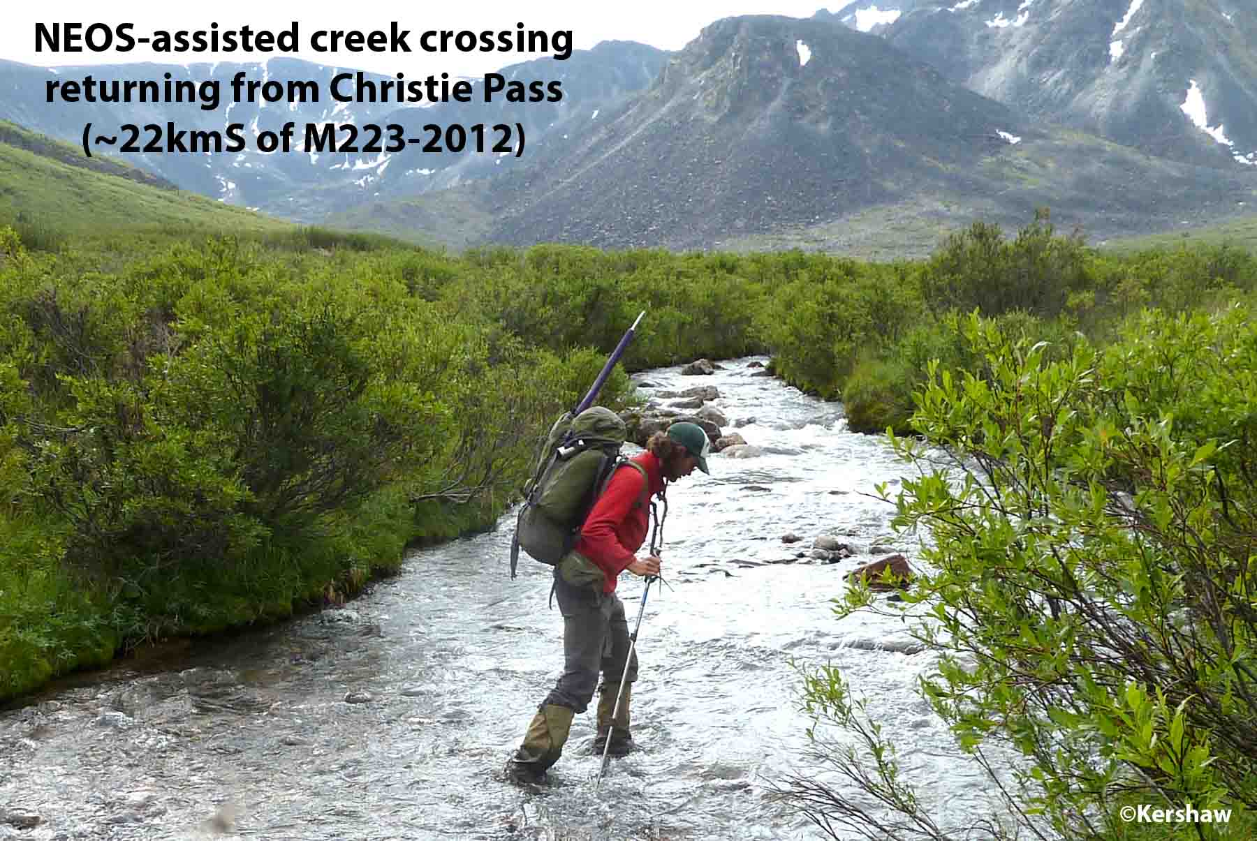
- To reduce the risk of injury we highly
recommend a separate set of river-crossing shoes. Wet feet can
turn into hamburger and we have mapped almost 70 creek, stream
or river crossings where it is advisable to wear water shoes.
This number is exclusive of the 50+ crossings of Dodo Ck (~M24
to 39), all the permanent ponds and wetlands to cross, and
drainage surges associated with heavy rains. One product we
have found is the NEOS
Overshoe (38 cm tall, weighing 635 g) which can be
pulled over your hiking boots to allow wading through water,
wet vegetation or snow. They keep your footware dry and you
retain all the function of your hiking boots.
- Crossings of the Carcajou #1 (M23) and
Twitya (M131) Rivers (and sometimes even the Little Keele M50)
normally require swimming. One product that has recently
proven its worth on the Canol is the Alpacka
inflatable raft (2.2kg) which is capable of carrying
you, your pack and even a bike across any water body on
the route (except the Mackenzie!). Even smaller water courses
(such as Andy Ck, Deca Ck, Godlin R or Ekwi R) can become
impassable after rain and ponding behind debris flows can
temporarily block the Trail (as has happened in Dodo Canyon).
Current Use Of The Land
The Trail is embedded in two Northwest Territory Park Reserves -
Doı T’oh (M23 to 48.5, Dodo Canyon area) and the Canol Heritage
Trail (M6.5 to23 and M48.5 to M219.5). The municipal boundary for
Norman Wells encompasses Pump Station No. 1 and Camp Canol and
there are several Sahtu Settlement Lands traversed by the Trail
(~M116 to 136, 164.5 to 168 and 220 to 231 [Yukon border]).
Most Canol buildings have been demolished by “clean-up” crews and
hazardous wastes such as asbestos removed. Any buildings still
standing are boarded-up to prevent unauthorized access.
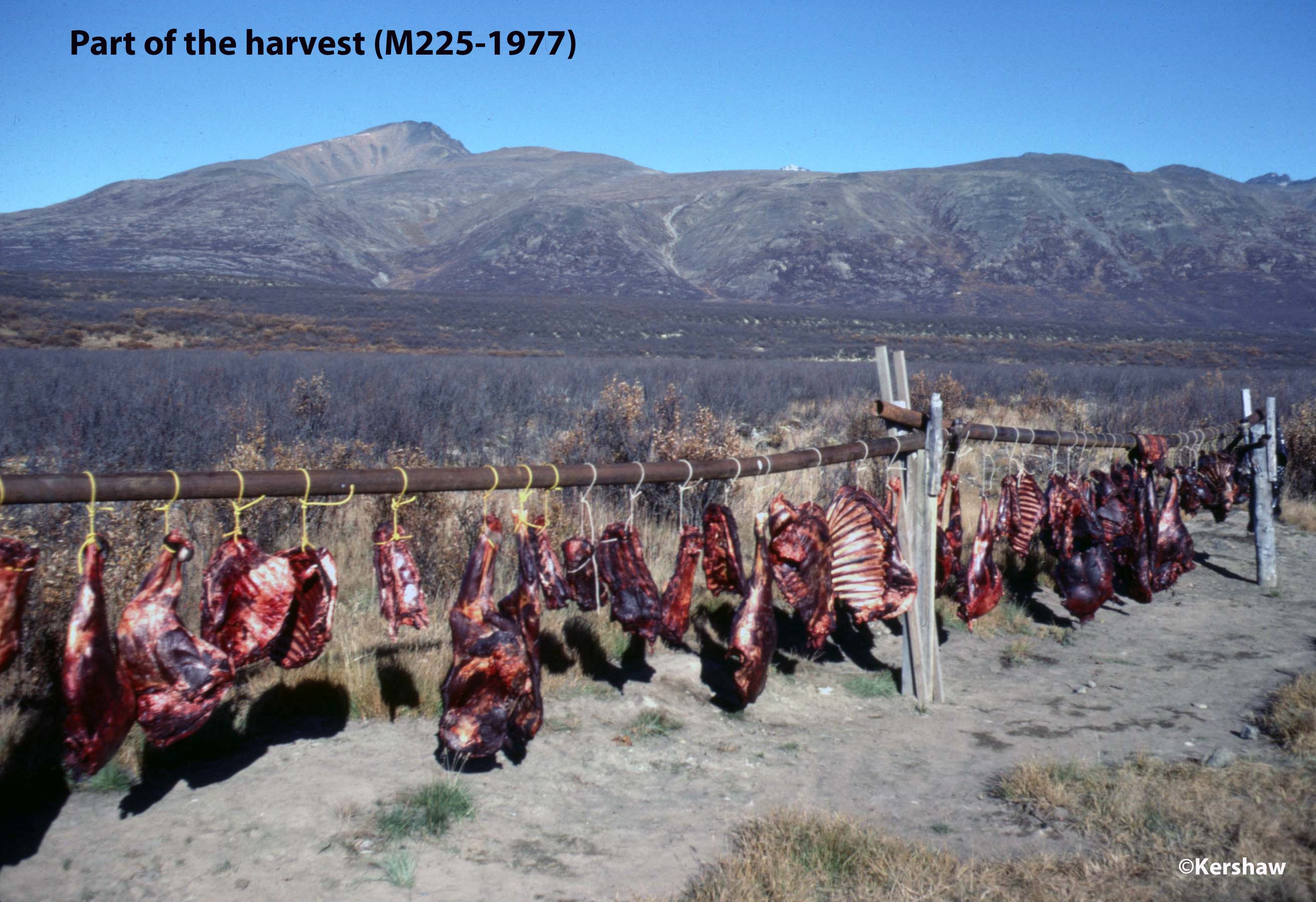
Today the area is a source of big game for meat and trophy
hunters. There are two outfitting zones that the Trail
passes through - MacKenzie
Mountain and Canol
Outfitters.
There are base facilities for two businesses on the trail - Canol Outfitters (M167)
and Dechen la' Lodge
(M212). Both have satellite facilities such as tent camps and
cabins on or adjacent to the Trail.
Respect the Land
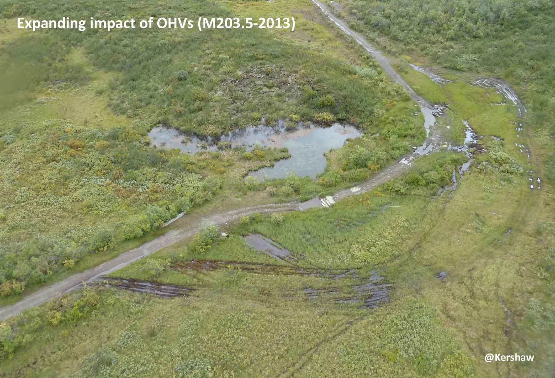
Without protected status, abuses of the land have accumulated over
time. 4-wheel-drive vehicles have been driven along hundreds of
metres of river and stream beds without respect for benthic or
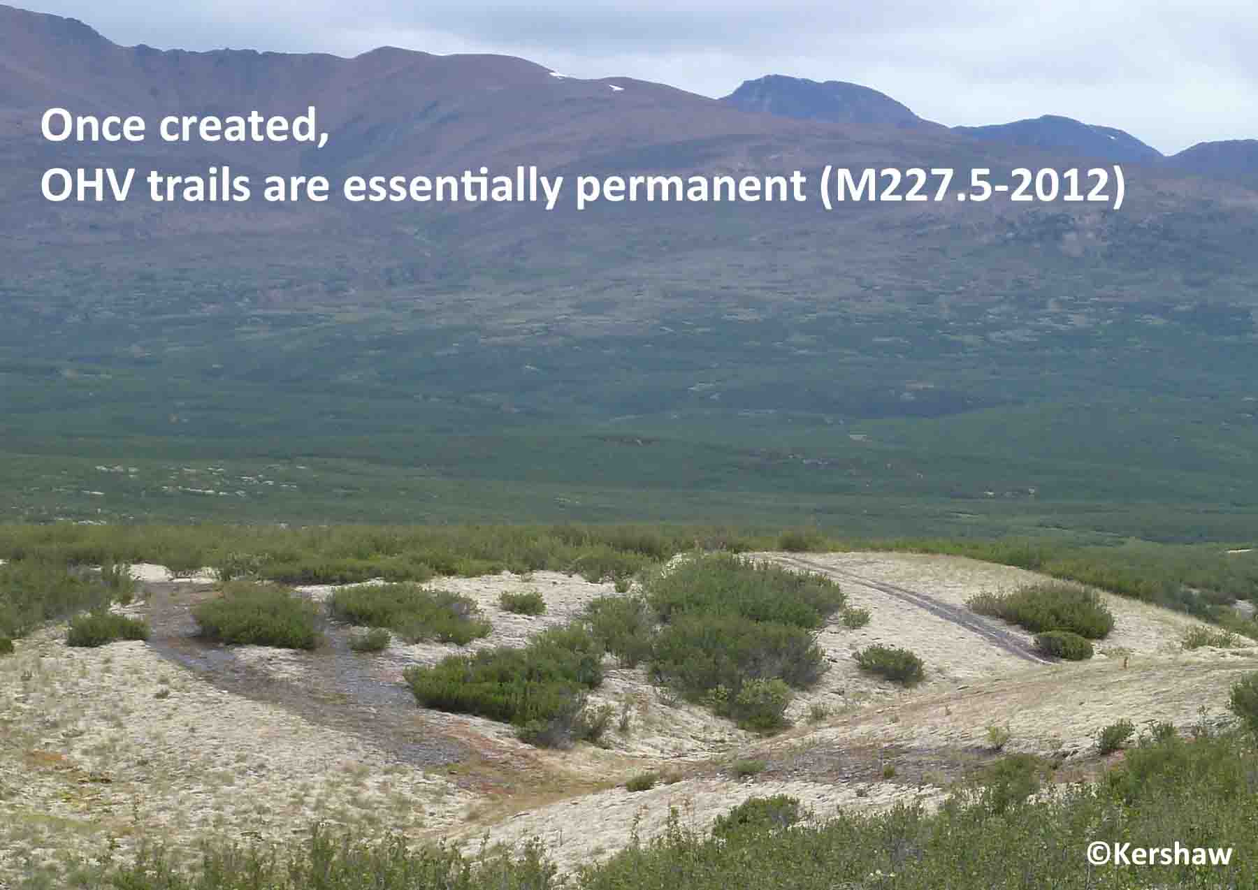
fish populations. Tens of kilometres of OHV/ATV trails have been
cut into pristine landscapes creating permanent scars on the land.
Vehicle trails through ice-rich permafrost terrain and wetlands
cause thaw and ponding so trails widen to increase damage to the
land. The effects of similar disturbances caused by the
CANOL Project still persist after almost 80 years and are clearly
visible to present-day visitors. It is sad to see such thoughtless
disrespect for the land and its unique character.

Over the past 40 years, we have noted dramatic declines in
caribou, Dall's sheep and moose sightings along vehicle-accessible
sections of the Trail. It is most likely that these
population declines have resulted from increased hunting
predation. We hope that reduced access by motorized vehicles will
give wildlife populations a chance to recover to their former
levels.
We will be updating
the content as time permits and as new material becomes
available.
Contact/Correspondence to: CANOLhiker@gmail.com
Updated: 20210401