Logistics & Resources
To deploy food
drops/caches and/or people, trekkers need to contact local
service providers. There are several fixed-wing access
points - lakes or rivers for float planes and informal landing
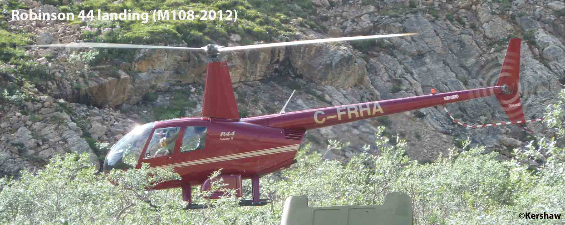
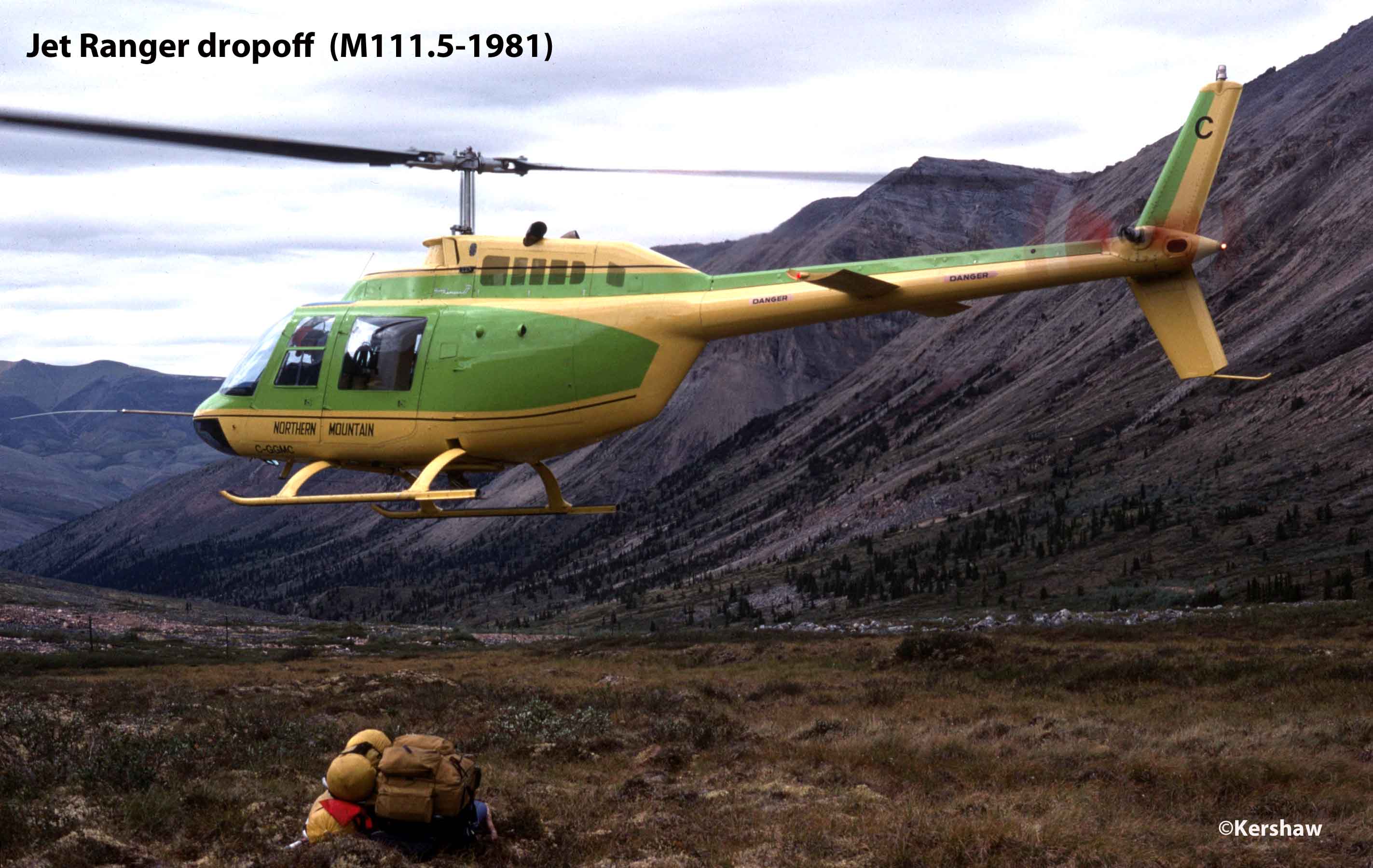
strips. Helicopters can land wherever you want but like
fixed-wing, weather dictates when and where. This can be a
problem when weather at departure or pick-up points precludes
flying. A further complication is wildfire smoke haze
(originating within or outside the region) which can ground
aircraft due to limited visibility.
For those not familiar with high latitudes, the daylight hours
are long. In early July you will have enough light to read
a map any time of the day or "night". Norman Wells is only
100km south of the Arctic Circle. Some may experience
trouble getting to sleep because of the strong light but for
charter flight scheduling almost the full 24 hours are
available. However, in winter the opposite is true.
Getting There
- Driving
You can access the Trail from
the south by driving north on the North Canol Rd (Yukon Hwy
#6) from Ross River to Camp 222 but there are no services so
you need enough fuel to do the ~480km return trip. Also
from the south, you can drive to Wrigley on the Mackenzie Hwy
(NWT Hwy #1) and then charter an aircraft from there to Norman
Wells or one of the fixed-wing access points along the Trail
(the rotor-wing alternative would be quite expensive if
available).
- Commercial Airlines
Commercial flight providers vary with your point of departure
but Norman Wells is serviced by First Air/Canadian North
Airlines. Flights to Whitehorse are available through
Air Canada or Nordwind Airlines.
Access
Points on the Trail
Helicopter access is unlimited but charter costs are more
expensive than for fixed-wing aircraft.
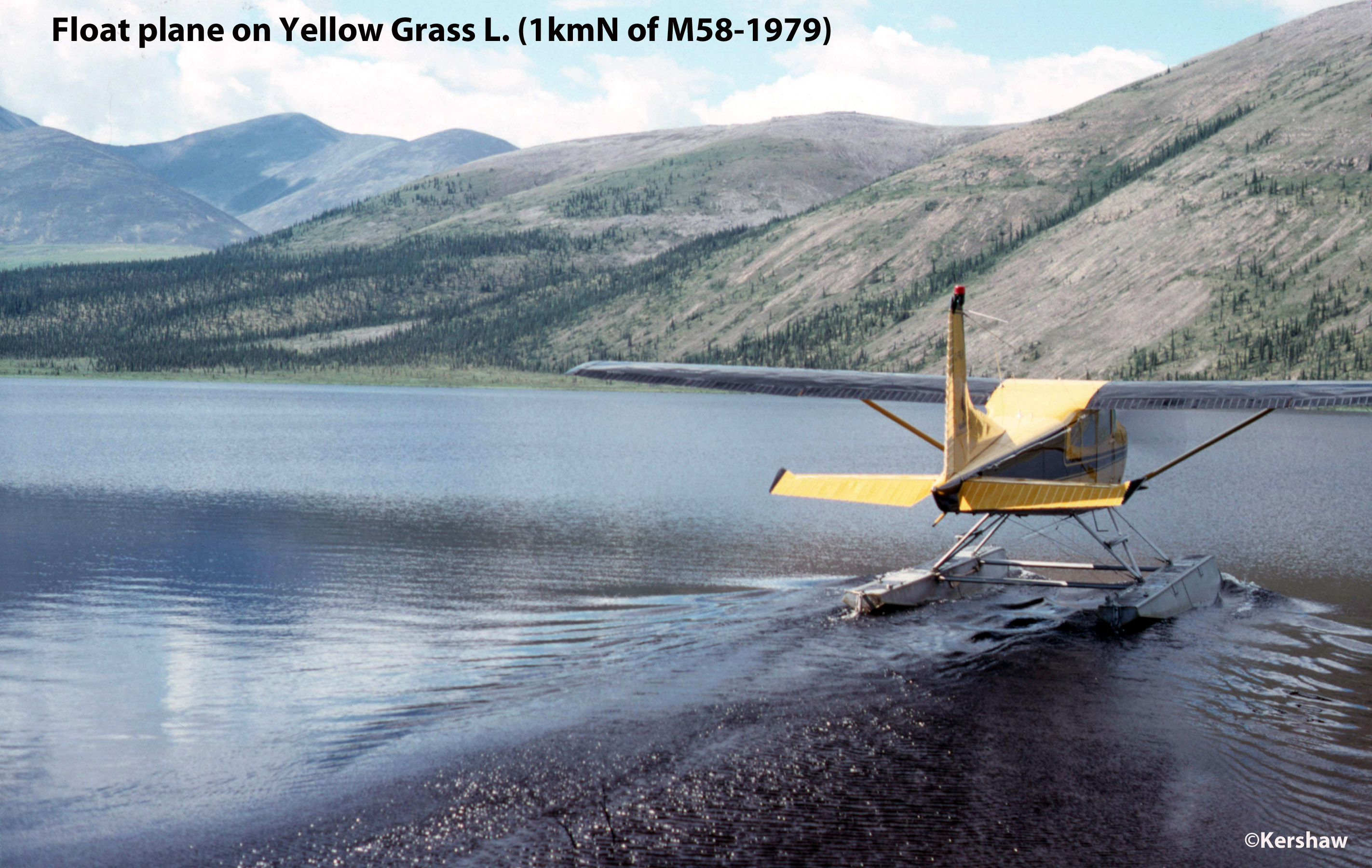
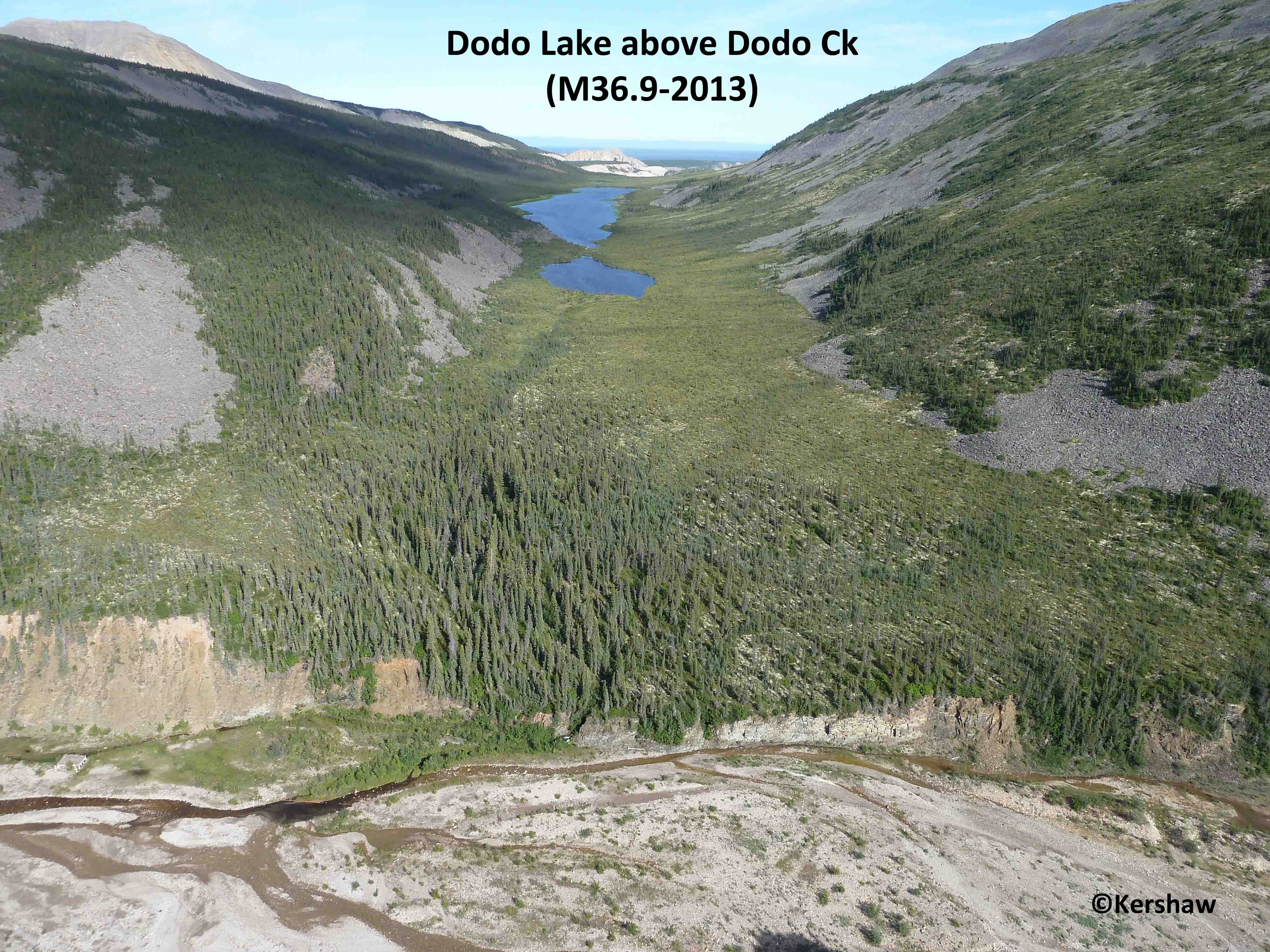
- Fixed-wing on floats
Heart L (Mile Post 8.4), Dodo L (1km W of
M37), Linton L (1km S of M40.5), Yellow Grass L (aka Canol L
1km N of M59), Carcajou L (~11km W of M73.5), McClure L
(~16km NW of M100) and Godlin L (M167)
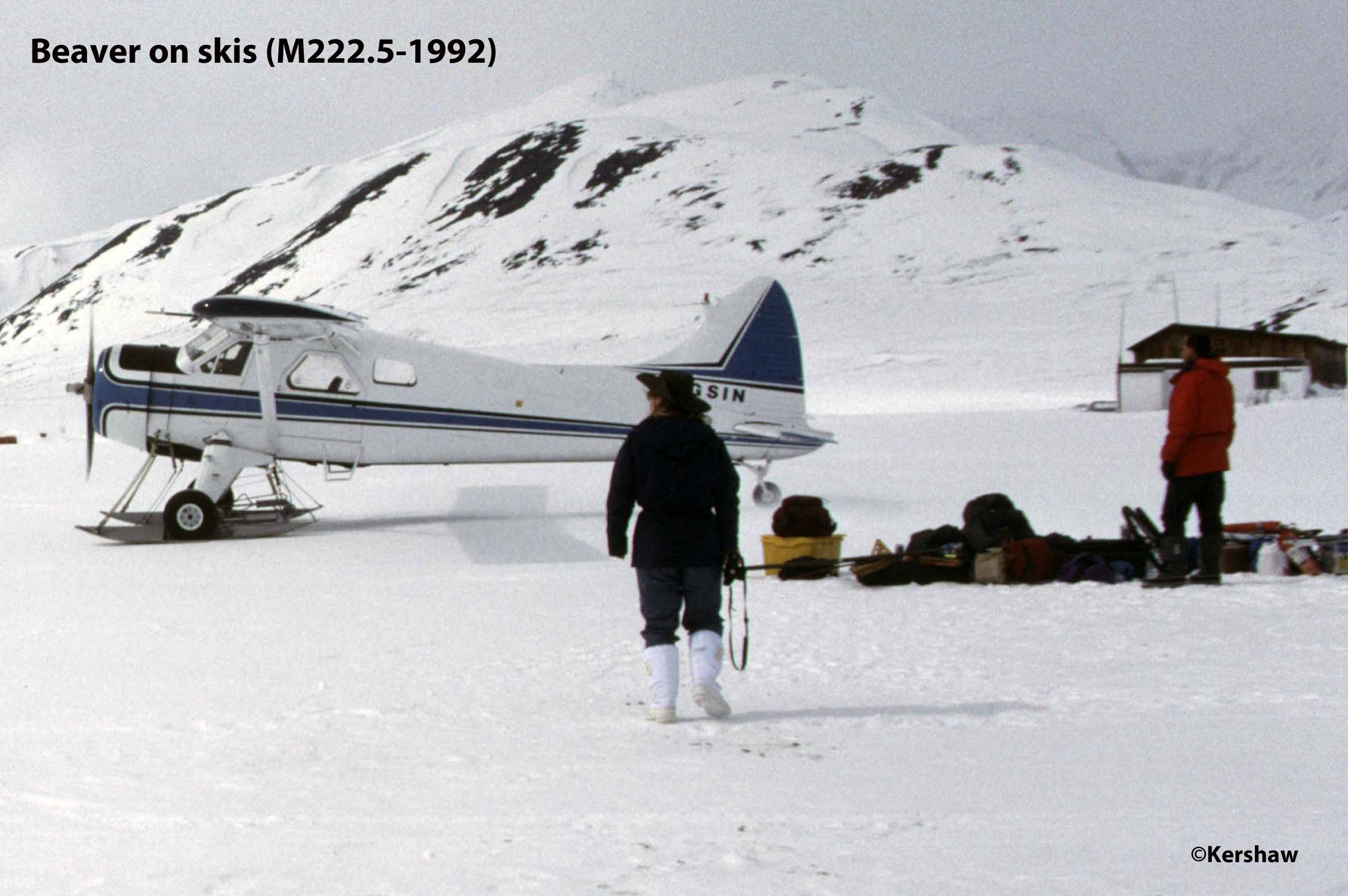
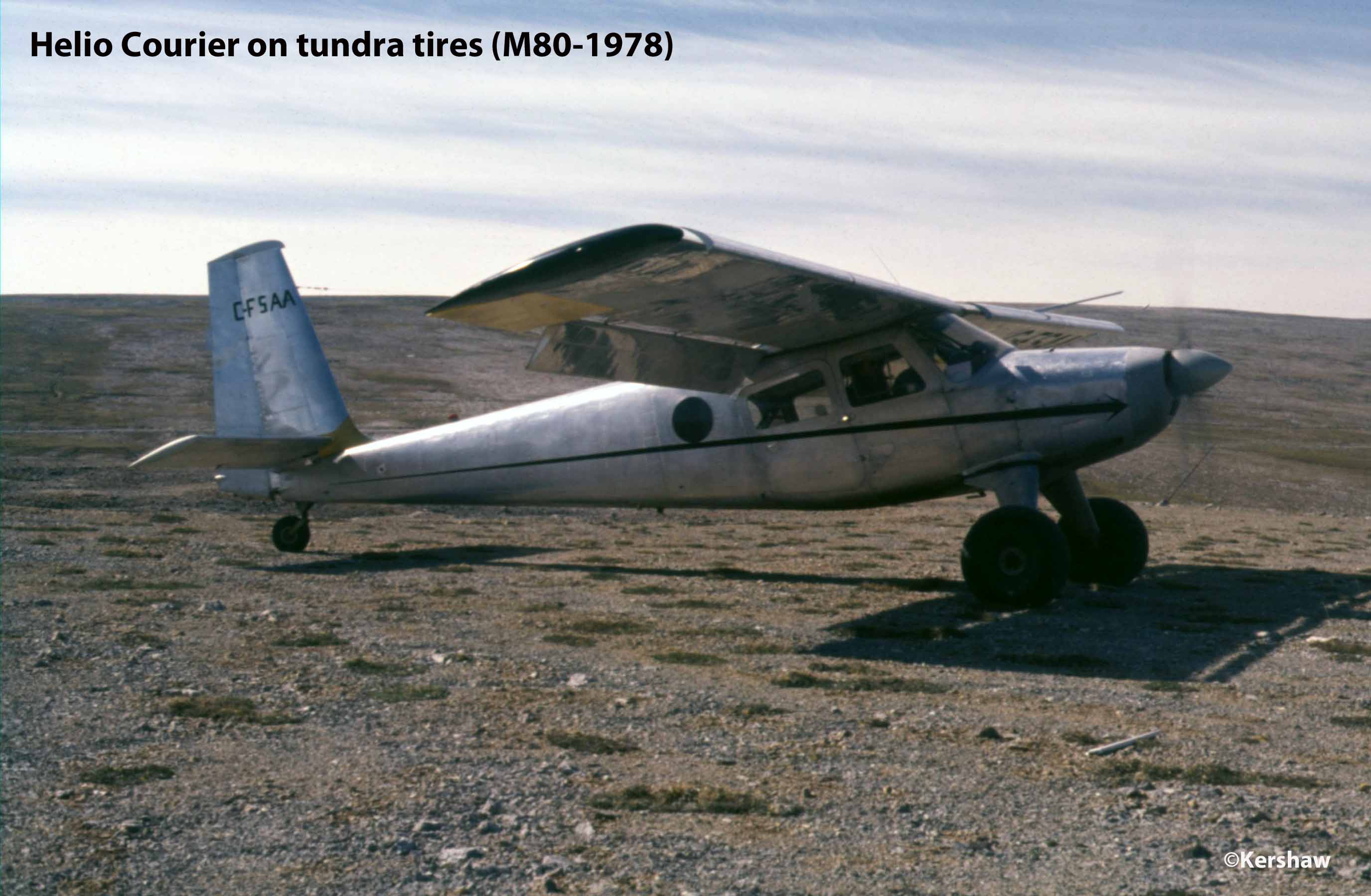
- Fixed-wing
on wheels
Canol Outfitters (M167), Camp 222
(M222.5) and MacPass Yukon (15km into Yukon).
Short Take Off and Landing (STOL) aircraft have landed
at M40, M80, M108, M133, M184 and M192 in the past but
with the advent of helicopters, fixed-wing pilots
seldom use these challenging landing spots any more.
Aerial Support/Charter Aircraft Contacts
based in Norman Wells, NT
Aerial Support/Charter Aircraft
Contacts based in Whitehorse, YT
There are too many
Whitehorse-based aircraft charter companies
to list here. It is best to browse the
Yellowpages
to contact the company of your choice.
Accommodations
on the Trail
Canol
Outfitters at Godlin L (M167) and Dechen la'
Lodge (M212) can be contacted to
determine if accommodation can be
arranged. Do not assume they will have
space, reservations only.
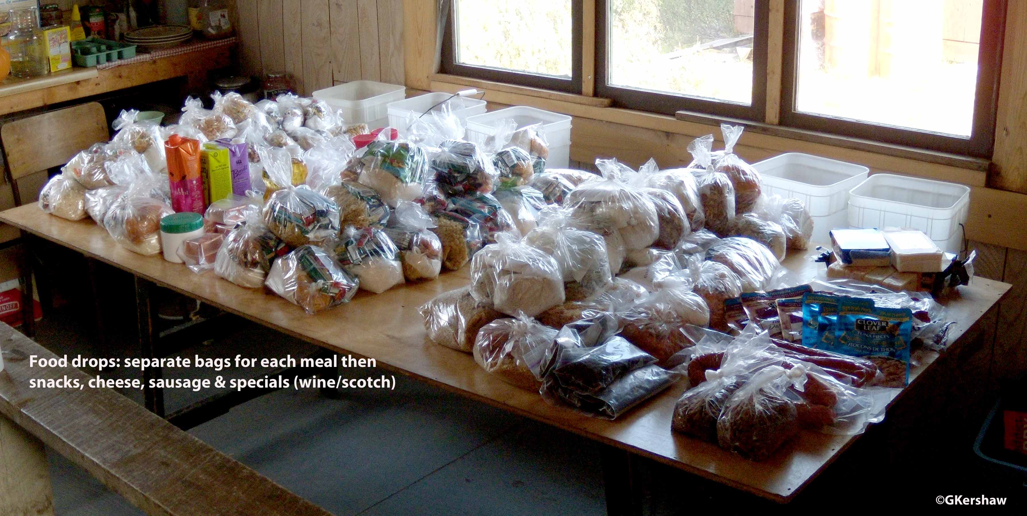
Food Drops/Caches
Unless you plan to carry
all your supplies you will want to deploy
supply caches for food and consumables
(e.g., fuel, batteries...).
Locations commonly used in the past are
M80, 108, 168 and 222 but with
helicopters, drops can be made anywhere
you wish. However, the container you
use and the site you select should provide
protection from the elements and security
from bears, wolves, wolverine, ground
squirrels and other curious animals.
Full Topographic Maps
Digital versions of
the 1:50,000 scale maps are available for download
from the Government of Canada. At the
site go to the table and click on Access
for the format you prefer – GeoPDF or GeoTIF.
The 1:50,000 metric maps are: 96d5, 96d11,
96d12, 105o1, 105o8, 105p5, 105p6, 105p10, 105p11,
105p12, 105p15, 106a1, 106a2 and 106a8 while the
remaining ones are still in imperial units:
96d14, 96e3, 96e6 and 96e7.
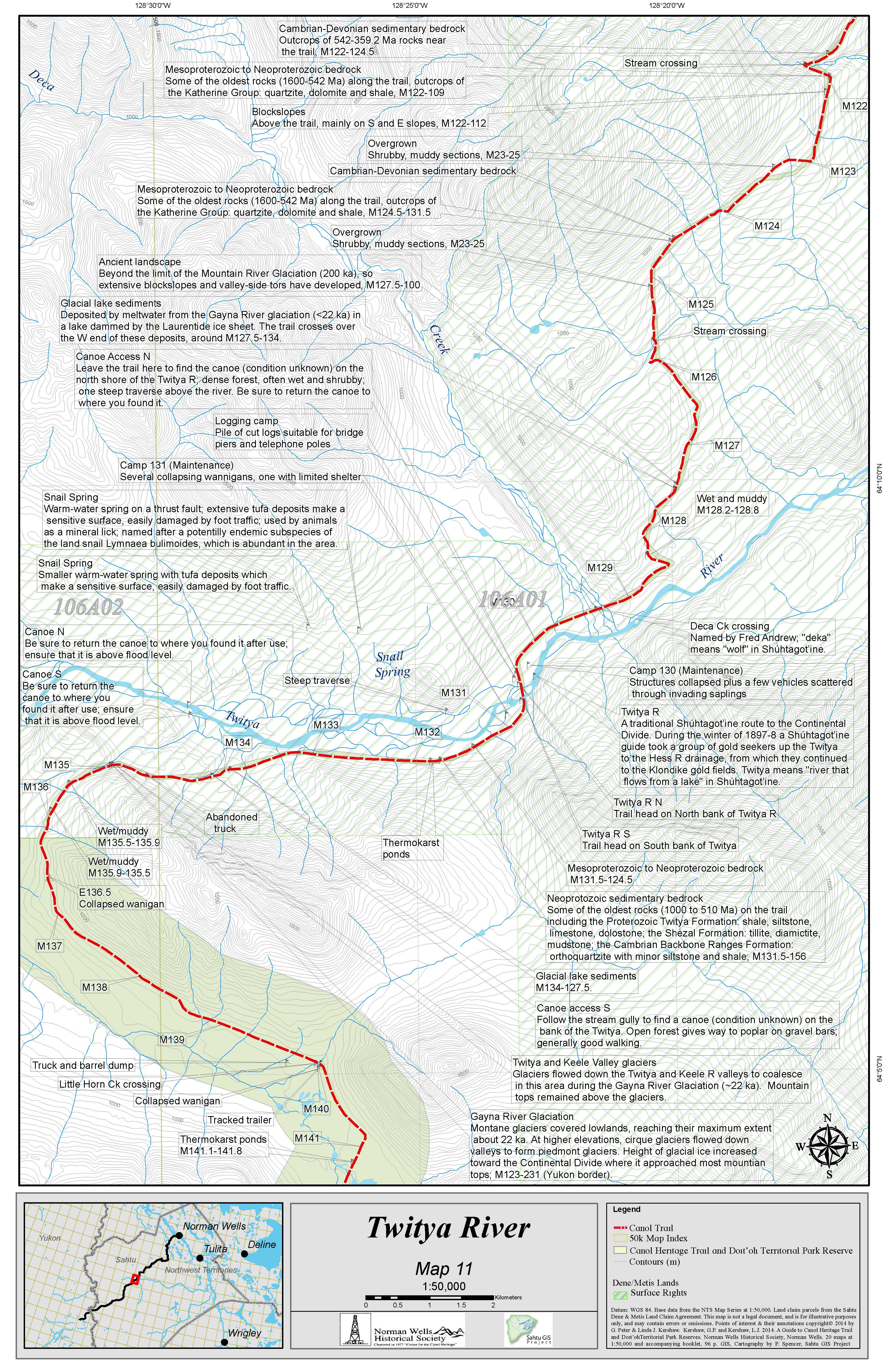 Canol Heritage
Trail Maps
Canol Heritage
Trail Maps
The Beta version of the 20 maps that accompanied
the first edition of the Guide to the Canol
Heritage Trail and DoI T’oh Territorial
Park Reserves should still be available from
the Norman
Wells Historical Society. These maps
locate over 900 points of interest superimposed on
the topographic maps at 1:50,000 scale.
Ecological, geological, historical and logistic
(stream crossings, hazards, etc.) notes are
located along the trail in addition to the sites
of the original Mile Posts.
Please Note:
It is a northern fact that businesses
merge, fold or form and that this state of
flux is the norm. Some of the links on
this page will change and if you can help
keep them updated, we would be pleased to
have your input.
We
will be updating the content as time permits and
as new material becomes available.
Contact/Correspondence to:
CANOLhiker@gmail.com
Updated: 20210329