Trail Information
Sources
The Norman
Wells Historical Society operates an excellent museum
and gift shop in Norman Wells. They are a great source
of information on the Trail and have copies of the first
edition of our guidebook for the Trail which includes beta
version maps of the route (20 maps at 1:50,000 scale with
>900 points of interest located).
The second
edition, A Guide to the Canol Heritage Trail (2019; 190
pages; 240 gm), is available through Amazon.ca
(Canadian source) or Amazon.com
(international source). This edition does not include
the maps, but has larger photos, a colour key to the
wildflowers, and several additional plant and animal species
(especially in the lichen and moss sections).
Individuals
and groups have compiled records of their experience of the
Trail and copies or links can be found on the Journals page.
Current Conditions
This is a wild area and the
condition of the Trail can change dramatically in response to
events as ephemeral as recent weather. Information can be
quickly dated and there is no group/agency with oversight or
responsibility to monitor changes and provide updates.
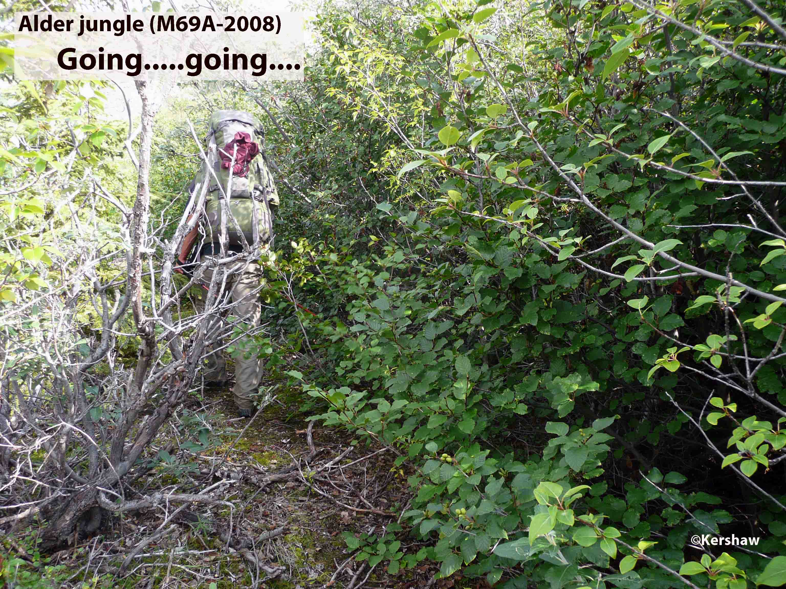
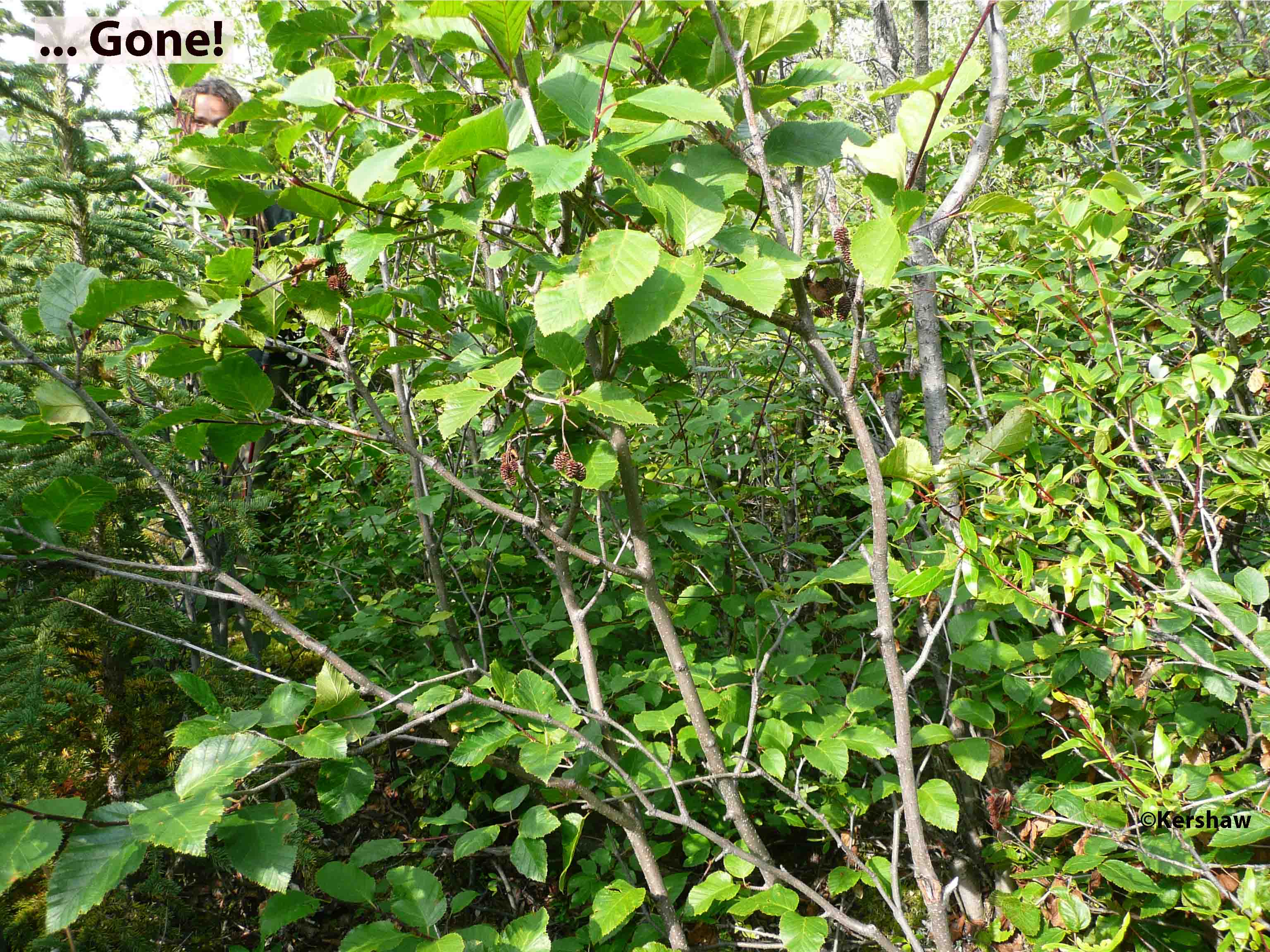
Gradual changes such as the encroachment of dense shrub and
trees on the trail are predictable but random events such as a
landslide that dams Dodo Ck to form a lake cannot be
anticipated. We welcome any and all information you wish
to share and we
will update the Guide and the web site accordingly.
Designation of the Canol Heritage Trail Park could greatly
enhance the trekker experience. Investment in work to
clear enough of a passage for trekkers through overgrown
sections would improve the experience and reduce the risk of
people losing the Trail. Spanning dangerous river
crossings with cables would significantly reduce safety risks on
the Carcajou #1 (Mile Post 23), Little Keele (M50) and Twitya
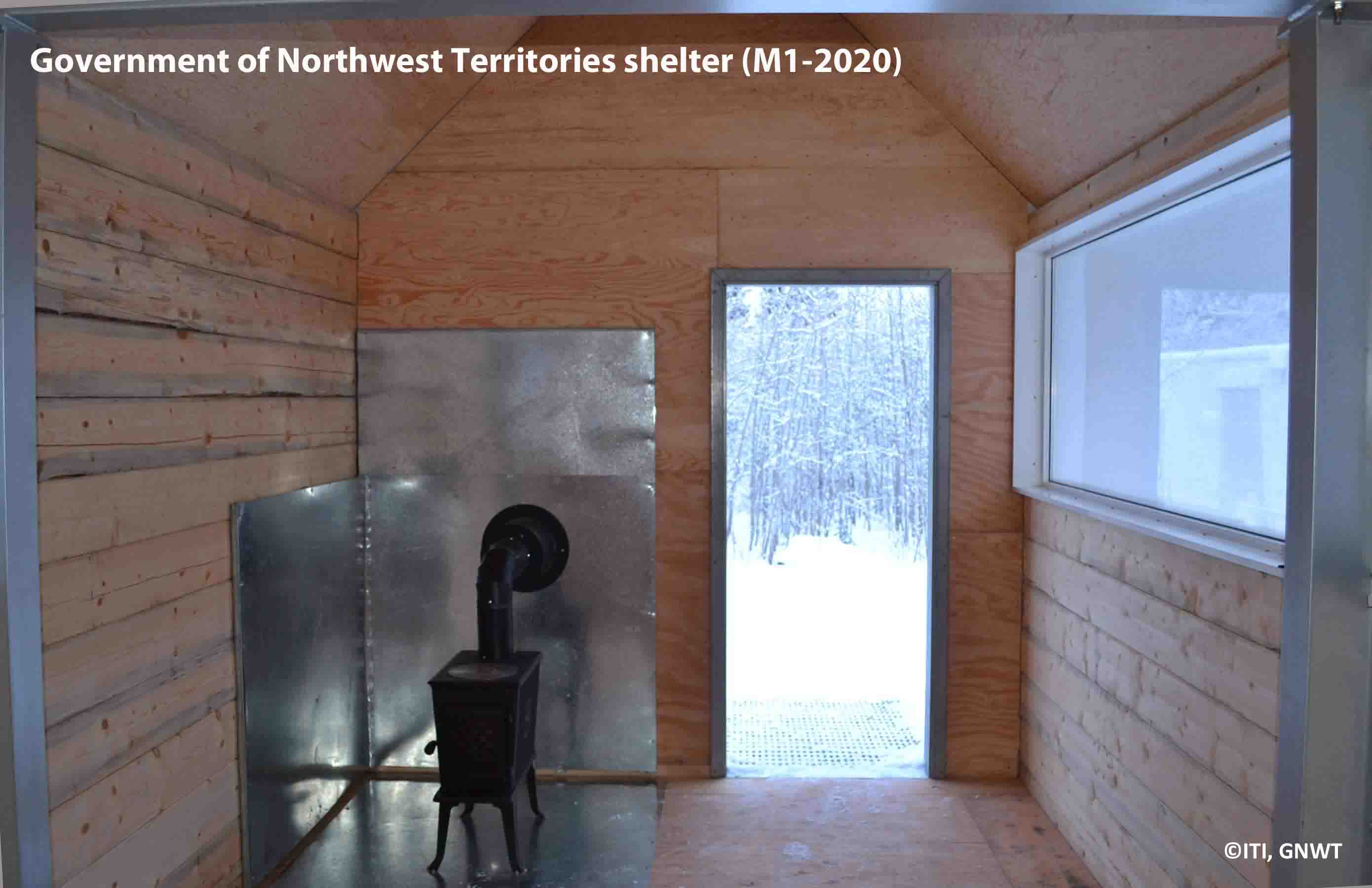
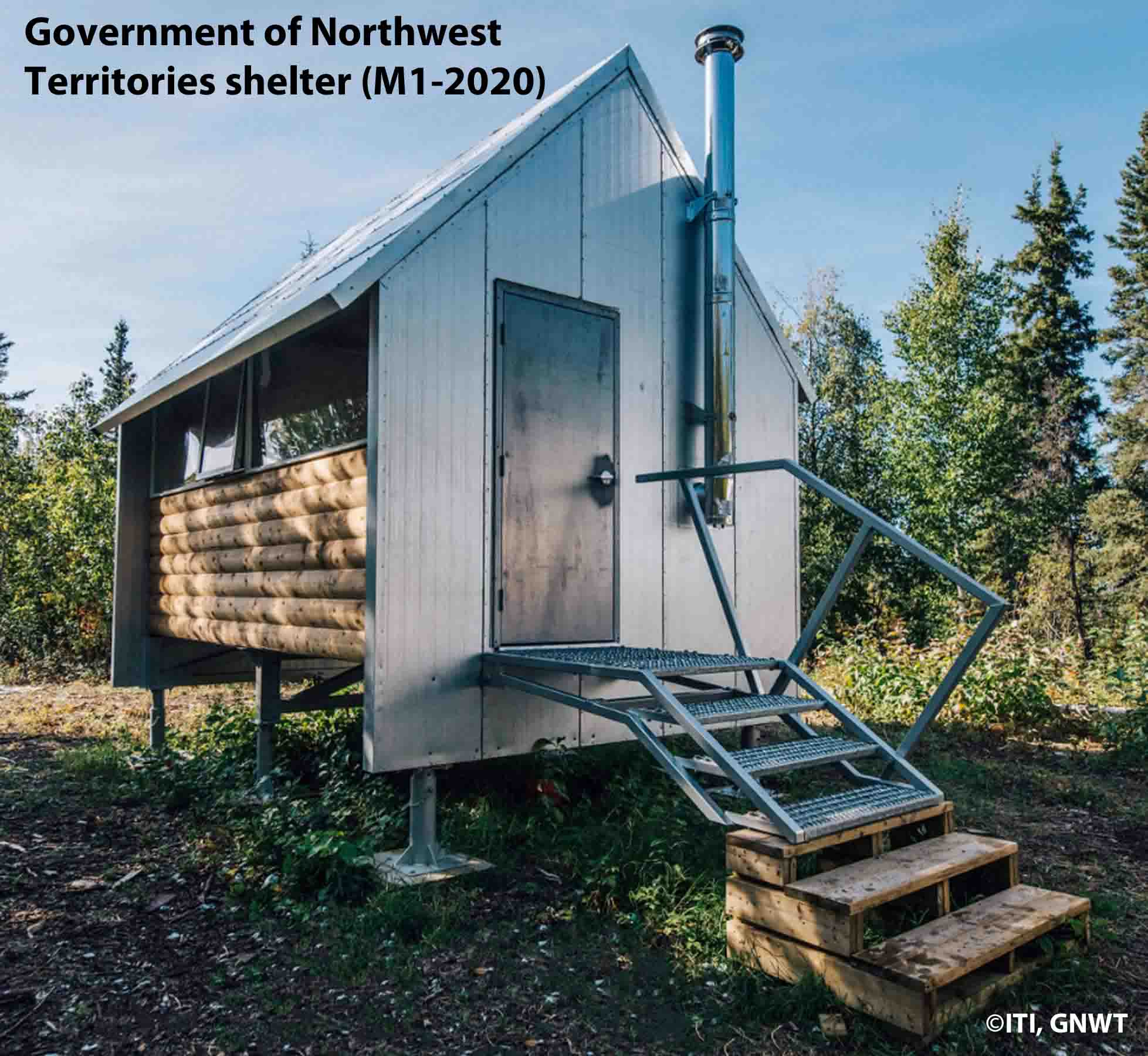
(M131) Rivers. The Government of the Northwest Territories
has constructed shelters on the Trail (M1, 8, 50, 75, 100 with
M125 and 150 planned for 2021) and these could be critical in an
emergency. Thanks to Dennis at Canadian Helicopters Ltd we
have coordinates for three of the new shelters: M50 at
64°44'58.84"N 127° 6'50.11"W; M72 at 64°39'44.14"N 127°35'8.19"W
and M100 at 64°26'45.65"N 128° 3'57.75"W.
Alternate Routes
There are a couple of
places on the Trail where two road beds mean you have a choice
of route:
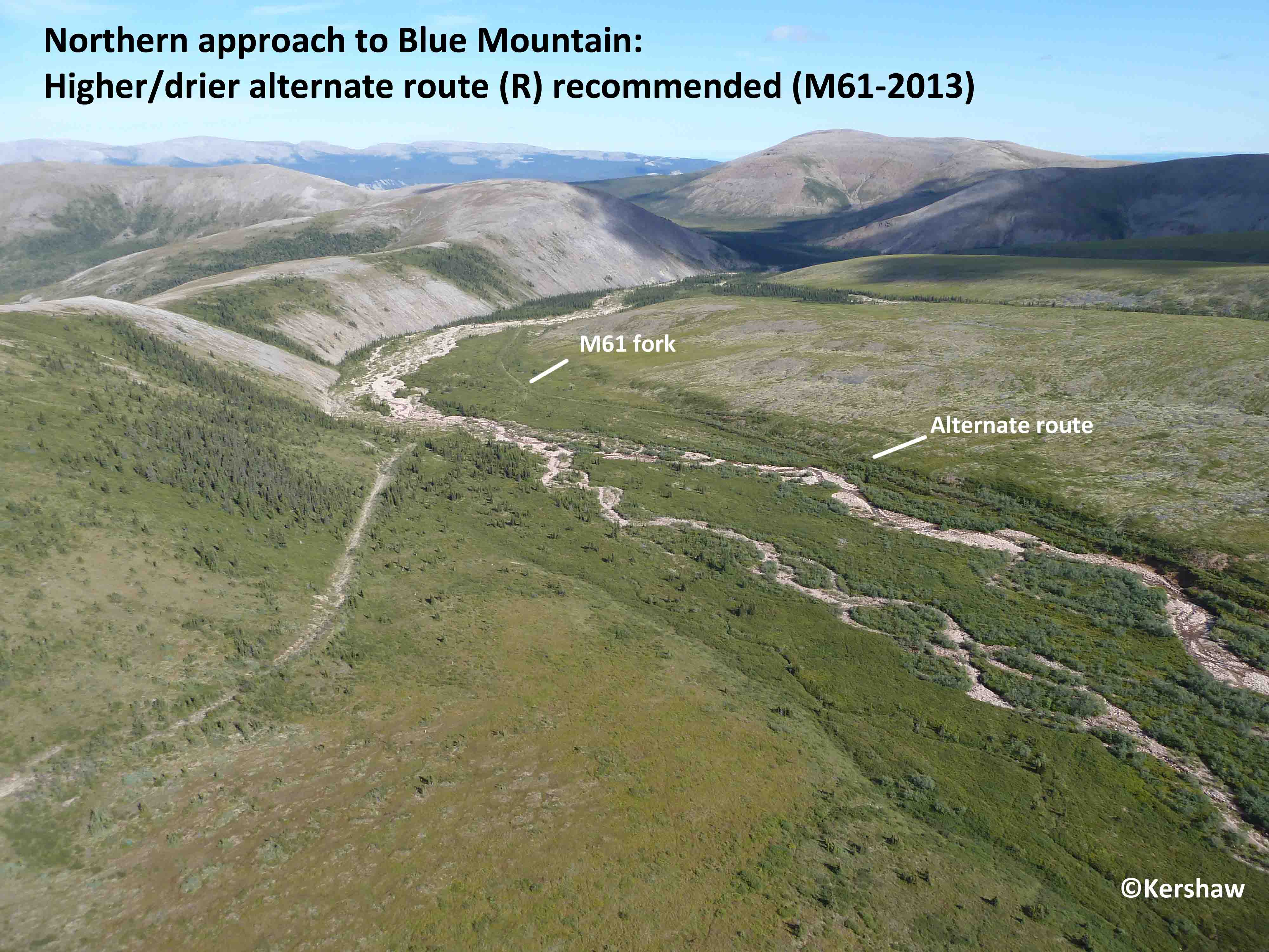
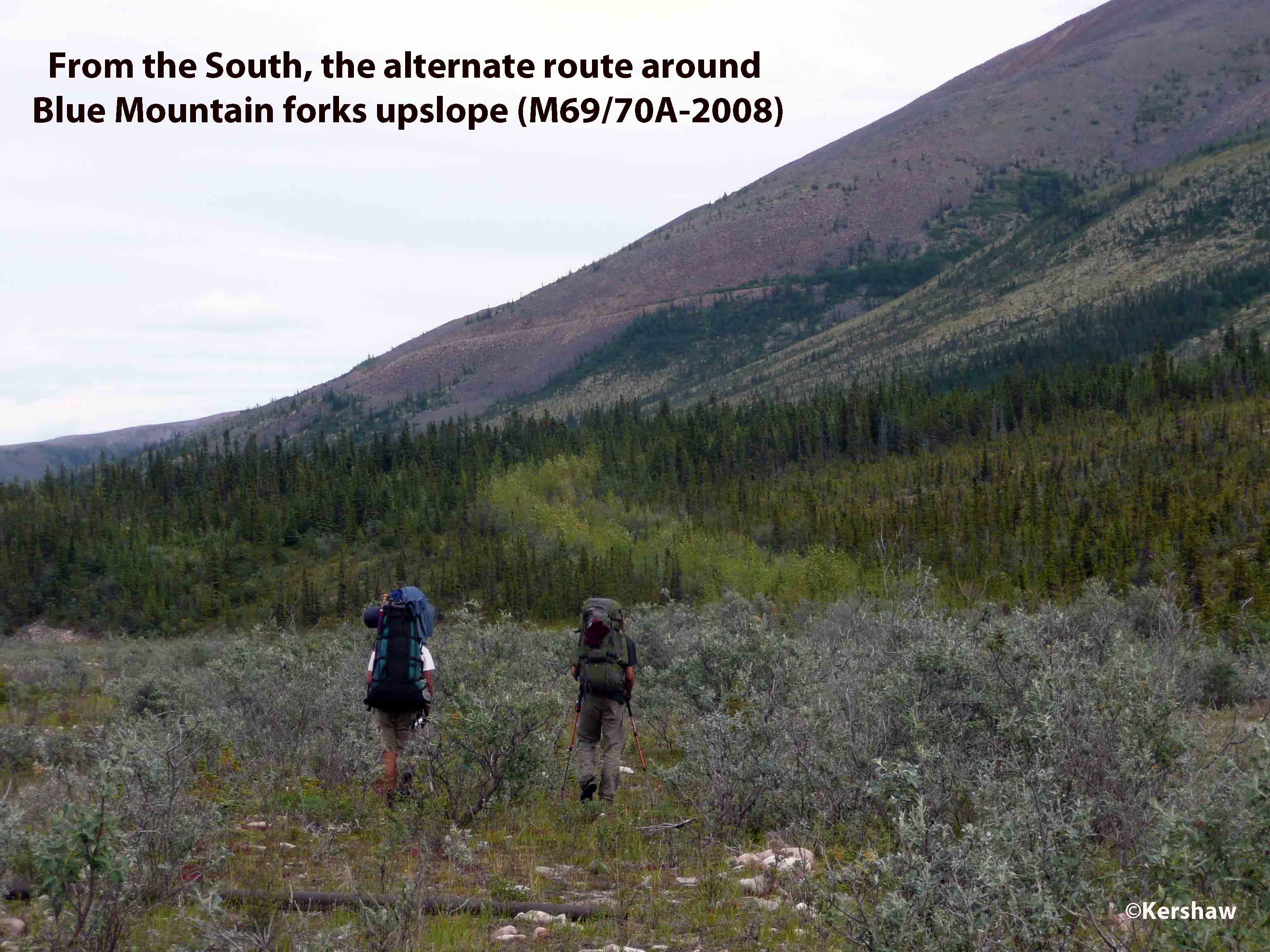
- Blue Mountain (M61 to
69 vs M61A to 70A)
The North approach to both
options is relatively easy to see but from the
South the divergence is obscured by dense stands
of shrubs and trees along a creek bed. The upper,
alternate (A) route on Blue Mountain is 1.6 km
longer (M61A to 70A) and provides solid footing
while the lower track drops to the Little Keele
(M65.2) where you are better off sticking to
cobble hobbling along the river bottom than
attempting to the brushwack the soggy track to
M69. The alternate is not without issues as you
must contend with greater elevation rise and there
are several sections with dense shrub/spruce
overgrowth which impedes hiking for 50 to 100m at
a time. There is also a steep washout to negotiate
at M68.5A. Despite these issues, we much prefer
the alternate route with its superior views.
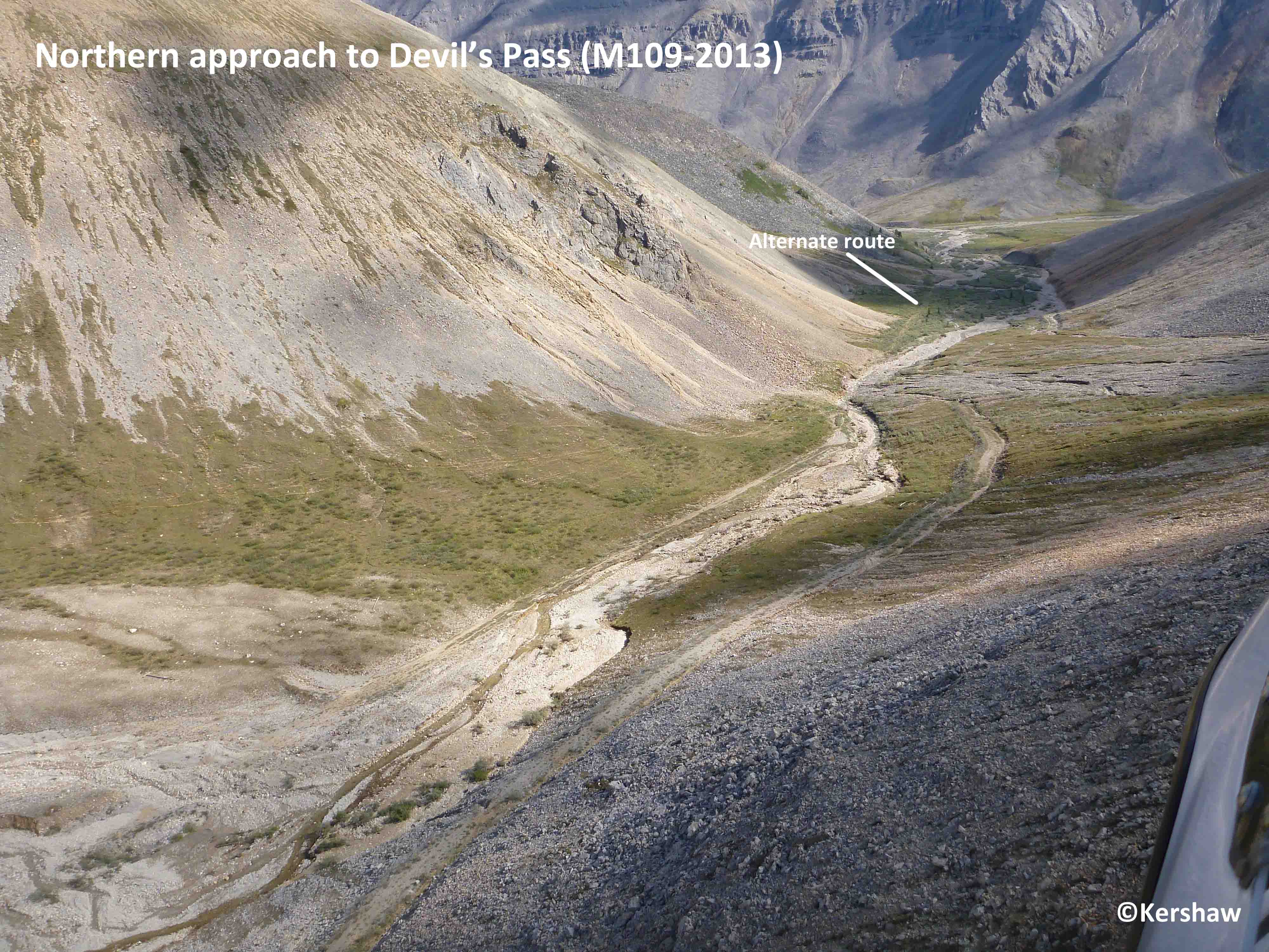
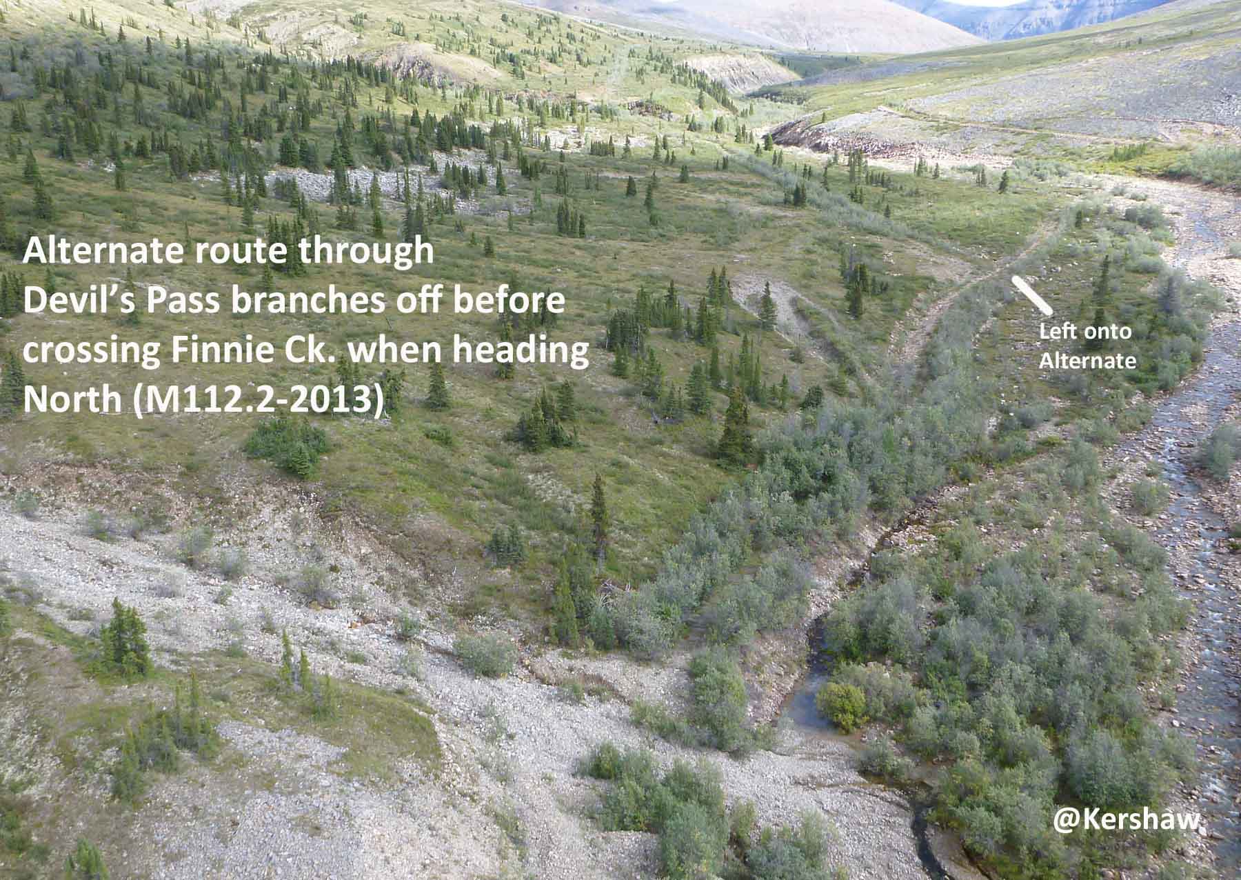
-
Devil’s Pass (M109 to 112 vs M109A
to 112A)
The alternate
route is slightly shorter
with less elevation
difference and more shrubs.
Both options require stream
crossings and once again we
recommend the higher route
for its superior views.
Don't Lose It!
There are a few points on the Trail where we have
heard that trekkers have missed the track or been
sidelined off the real route.
- Mile 10
Don't take the track to the East which was an
attempt to push the road through to the Carcajou
R. in Summer 1942. The failed route was later
abandoned in favour of the one Fred Andrew, George
Blondin and [Little] Edward Blondin guided the
surveyor Guy Blanchet along in Fall/early-Winter
1942.
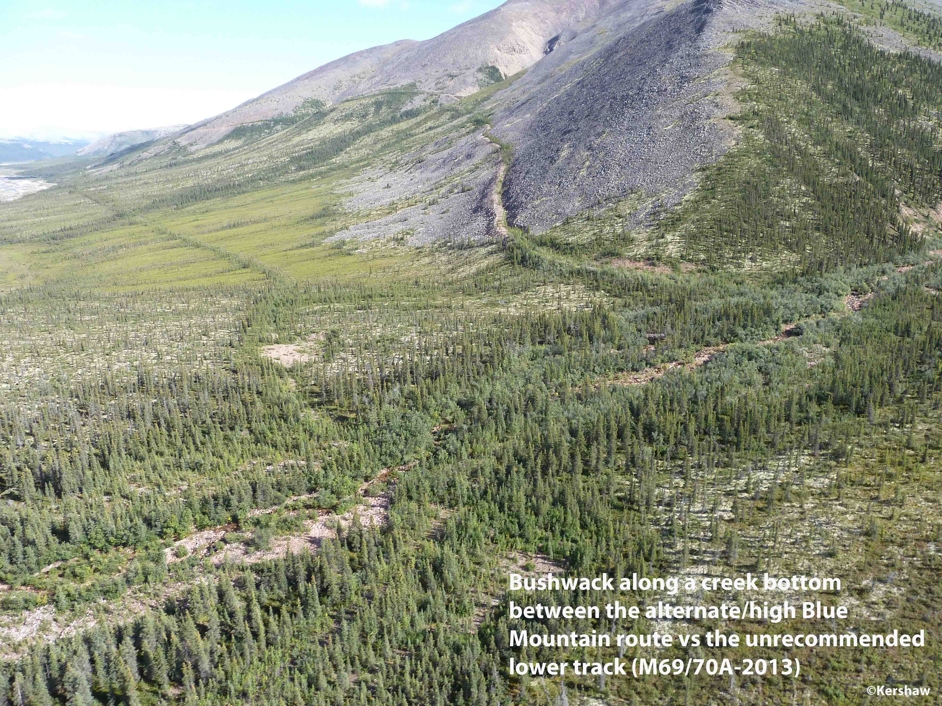
- Mile 69/70A
The branch to the higher elevation alternate route
on the North flank of Blue Mountain is not clear
when approaching from the South. If you are
intending to take the lower route then it is best
to stay on the Little Keele until M65.2 where the
Trail heads SE to climb over Blue Pass to
M61. To take the upper route which is 1.6 km
longer, there are some dense brushwacking sections
at first, but you leave them behind and enter
alpine tundra by M67.5A.
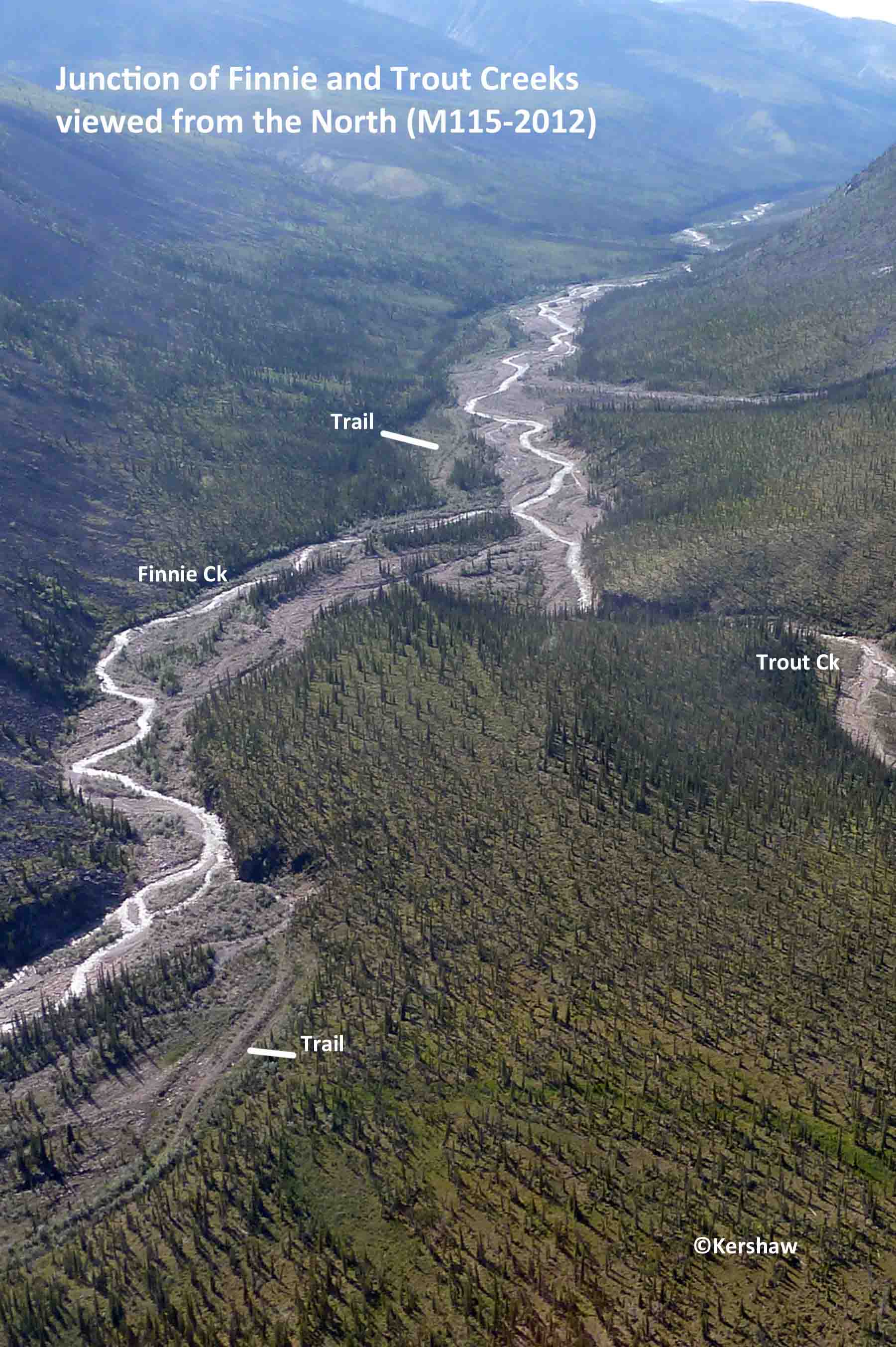
- Mile
115.3
The road bed disappears near the
confluence of Finnie and Trout
Ck., going South keep left (South)
after Finnie Ck. joins Trout Ck.
and if going North, keep to the
right fork (North) and catch the
road bed a little further up
Finnie Ck.
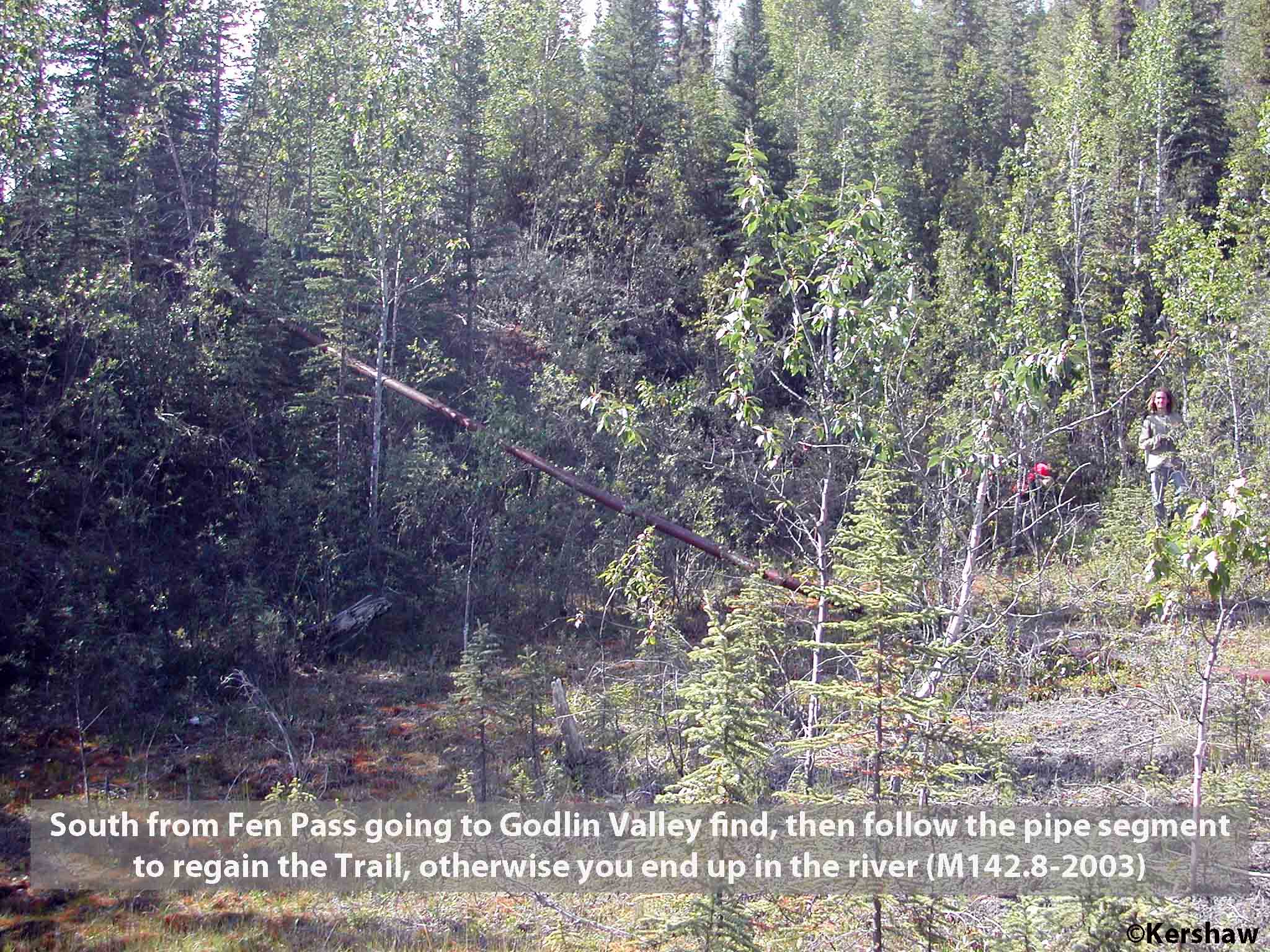
- Mile
142.8
Going South after Fen Pass there
is a washout/slump and the old
roadbed is gone. Look for
a piece of pipe sticking out of
the foliage along the base of
the slope. If you follow
the pipe up the slope you will
regain the Trail.

- Mile
143-145
Keep on the North side of Godlin R. since
there are several washouts and slumps in
this area. You could see a section
of road bed on the opposite bank but don't
be fooled, stay North.
 Dammed Water
Numerous shallow ponds flood
the Trail between M2 and 19. These
are the result of ice-rich permafrost thaw
and flooding by beaver ponds.
Elsewhere on the Trail, trekkers will
encounter deeper water bodies.
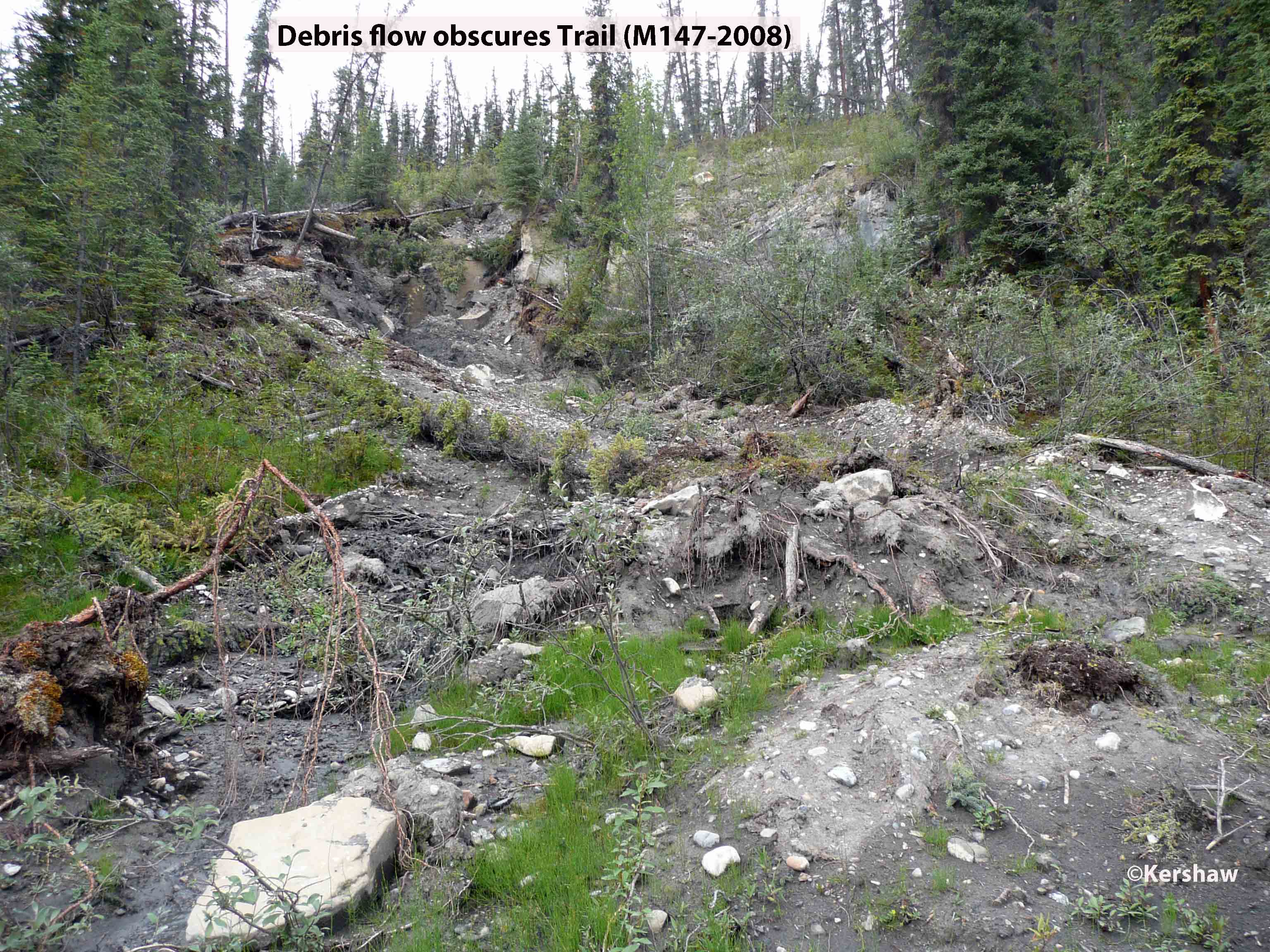
- Mile ~32.5
We do not have the exact location of the debris
flow(s) that have periodically dammed Dodo Ck. to
create a 500-m-long lake. A local helicopter
pilot indicates that it is possible to detour up slope
around the lake while others have
paddled/waded/swum. The damming is unpredictable
as reported by trekkers - present in 2010, 2016, 2018
and 2019 but absent in 2008, 2012 and 2013. This
lake forms and drains in response to debris flows
which can occur multiple times in a season.
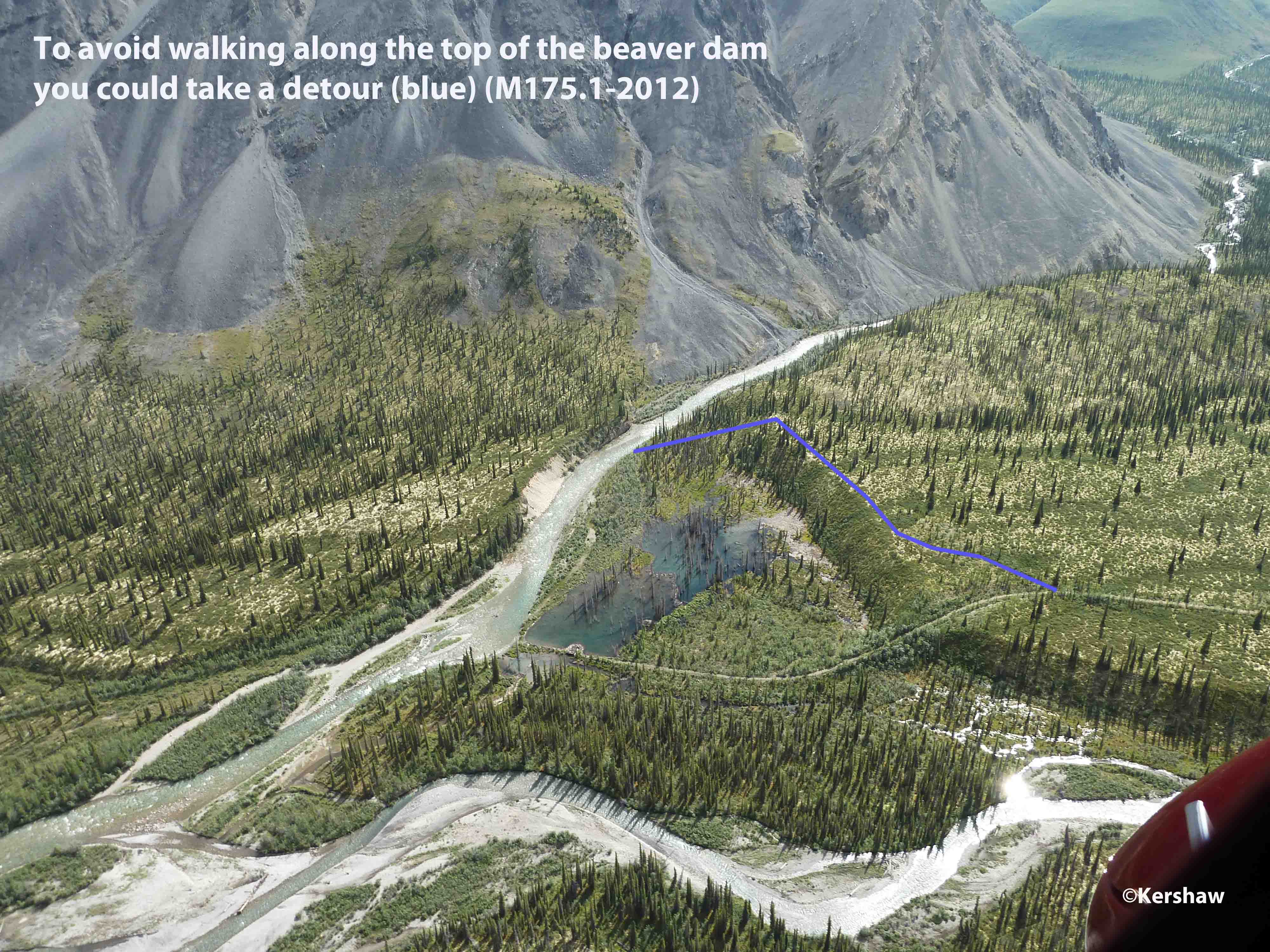
-
A beaver has
constructed its dam to incorporate a bridge and the
raised road bed. If you can't walk the top of
the dam coming from the North then after crossing
the Ekwi #2 walk upstream until you are above the
pond and then head up onto the terrace and back to
the Trail. From the South, leave the Trail
before dropping off the terrace and follow it East
until you are above the pond and then drop down to
the Ekwi to select the best spot to cross.
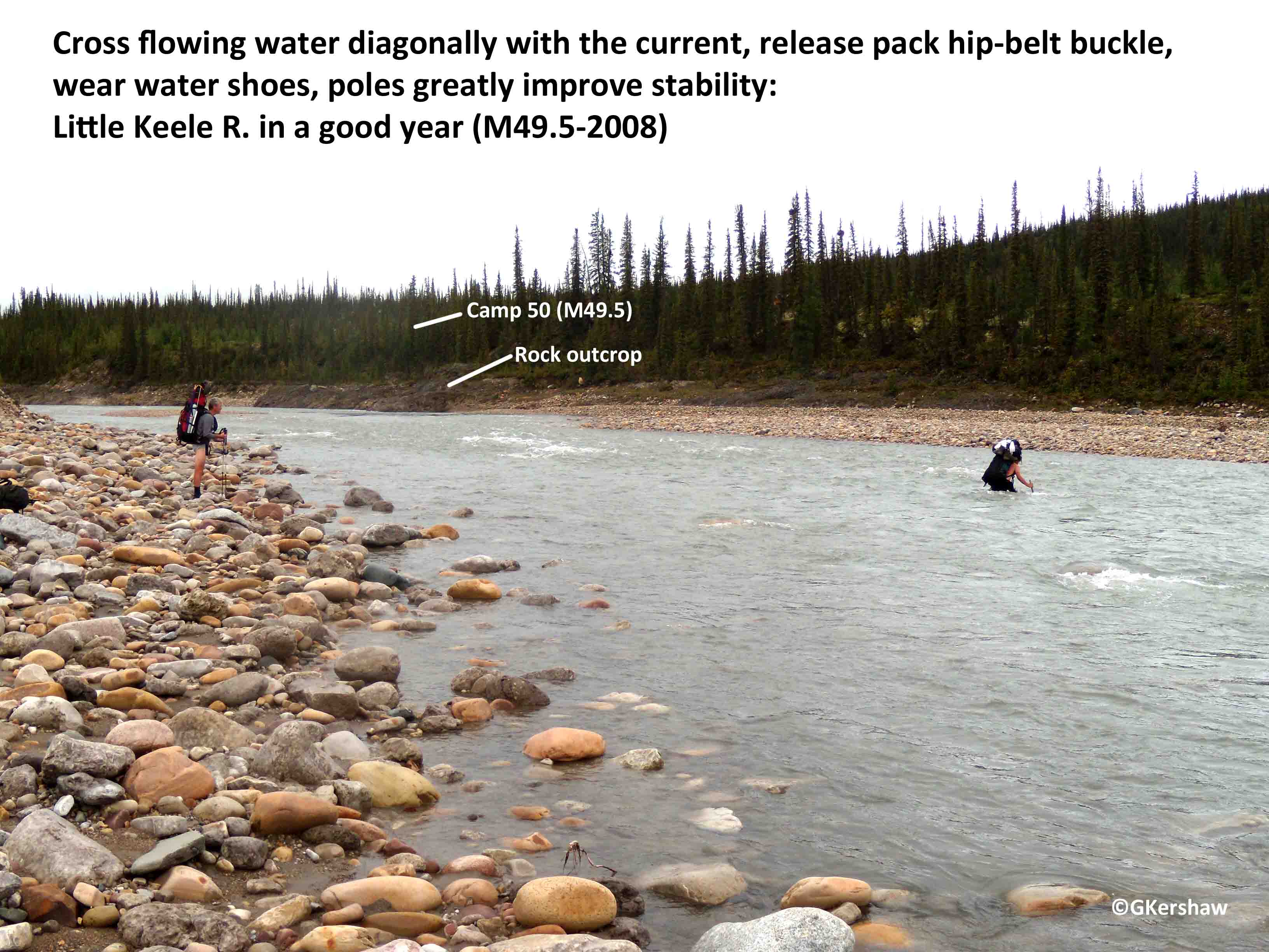
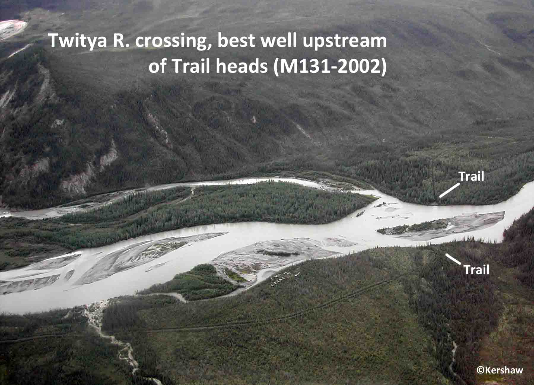
River Crossings
River
crossing conditions can change from hour to hour and day
to day, within a season or between years. Weather is
a big factor and unpredictable events such as debris
flows, beaver activity and channel changes can
dramatically alter conditions. Exercise extreme
caution whenever attempting crossings of water
bodies. Whenever possible move diagonally with the
current, release your hip belt, wear footwear to protect
your feet (you might not feel cuts or bruises in cold
water) and use pole(s) for added support. The
following are crossings known to pose problems in the
past.
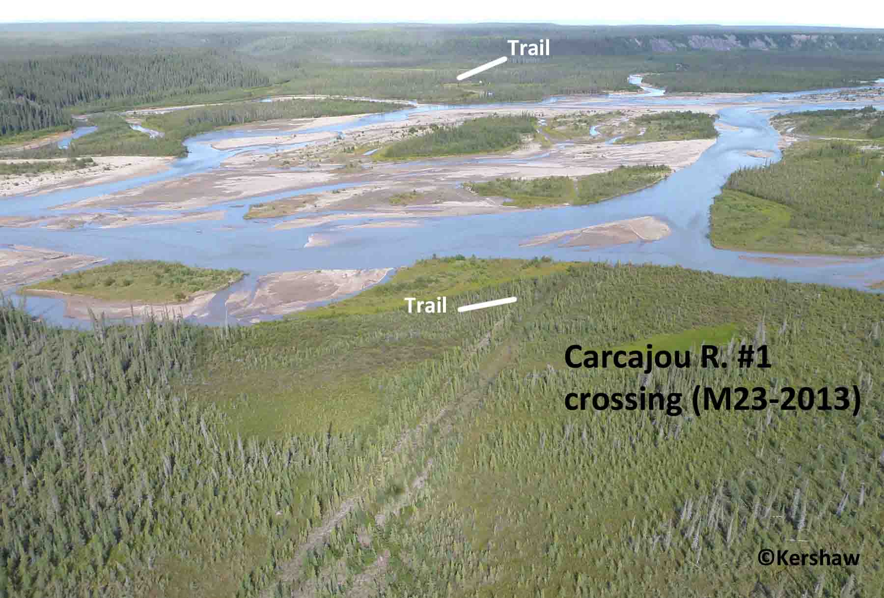
Carcajou River #1 M23

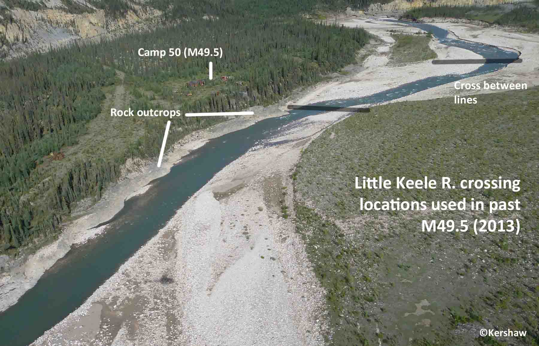
Little Keele River M49.5
Twitya River M130.6
We will be
updating the content as time permits and as new material
becomes available.
Contact/Correspondence to: CANOLhiker@gmail.com
Updated: 20210401